Inscription
Commanded by Samuel L Freeman
— General Nathan Bedford Forrest's 1st Artillery Captain —
Freeman's Battery under the command of Captain Samuel L. Freeman, served with General Forrest from October 9, 1862 until April 10, 1863. On that day, while advancing toward Franklin, Tennessee on the Lewisburg Pike, General Forrest's command was attacked by the 4th U.S. Cavalry. Forrest's regiments were widely separated and Freeman's isolated battery was the focus of their charge. Freeman ordered the battery into action, injuring his knee while placing the guns. A primer failed, and the enemy captured 31 men and their guns.Hearing the gunfire, Forrest rushed toward the battery's position. Fearing Forrest's vengeance, the Federals cut the guns down, and ordered their captives to run or be shot. Unable to run, the unarmed and injured Freeman was shot in the mouth, killing him instantly. The battery doctor was also shot, but survived. The promising young teacher, law student and Forrest's first artillery captain had been murdered.
Captain Freeman was buried in Springhill, Tennessee, on April 11, 1863. In future engagements, General Forrest never gave quarter to the 4th U.S. Cavalry. Of Captain Freeman, Forrest said, "Brave man, none braver".
Command of the battery then passed to Captain Amirah Huggins who would command the battery until the end of the war. Years after the war, one of the battery's cannonneers stated, "we always held to the name of Freeman."
Details
| HM Number | HM1F2Q |
|---|---|
| Tags | |
| Year Placed | 2010 |
| Placed By | Freeman's Battery, Forrest's Artillery, Camp 1939 Sons of Confederate Veterans |
| Marker Condition | No reports yet |
| Date Added | Thursday, October 9th, 2014 at 4:35am PDT -07:00 |
Pictures
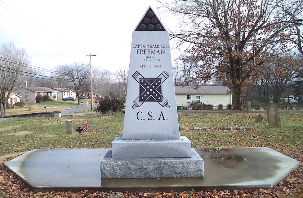
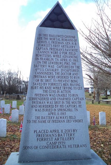
Photo Credits: [1] JESSI WINN
Locationbig map
| UTM (WGS84 Datum) | 16S E 522106 N 3943829 |
|---|---|
| Decimal Degrees | 35.63803333, -86.75583333 |
| Degrees and Decimal Minutes | N 35° 38.282', W 86° 45.35' |
| Degrees, Minutes and Seconds | 35° 38' 16.92" N, 86° 45' 21.00" W |
| Driving Directions | Google Maps |
| Area Code(s) | 931 |
| Closest Postal Address | At or near 4439 Pyles Rd, Chapel Hill TN 37034, US |
| Alternative Maps | Google Maps, MapQuest, Bing Maps, Yahoo Maps, MSR Maps, OpenCycleMap, MyTopo Maps, OpenStreetMap |
Is this marker missing? Are the coordinates wrong? Do you have additional information that you would like to share with us? If so, check in.
Nearby Markersshow on map
Show me all markers in: Chapel Hill, TN | Marshall County | 37034 | Tennessee | United States of America
Maintenance Issues
- Is this marker part of a series?
- What historical period does the marker represent?
- What historical place does the marker represent?
- What type of marker is it?
- What class is the marker?
- What style is the marker?
- Does the marker have a number?
- This marker could use another picture or two.
- Can this marker be seen from the road?
- Is the marker in the median?
Comments 0 comments