Inscription
Indigenous People. The original inhabitants of the lands around Accotink Creek lived as semi-sedentary hunters and gatherers who moved seasonally to fallow game. These peoples spoke varying forms of the Algonquin language. The river system provided them with a wealth of resources as well as a means of transportation. The waters teemed with fish and deer and other animals were drawn to its banks. Gathering and farming were also important lifeways. Corn and beans were combined as "succotash" making up half their diet, which was also supplemented with wild berries and nuts. Early peoples were also drawn to the area due to the prolific amount of quartz and other materials from which they could make tools, including projectile points and stone scrapers. With European advancement along the waterways beginning in the early 17th century, the Native Americans were slowly pushed off their lands.
Bridging the Gap. The railroad trestle was built as part of the Orange and Alexandria Railroad in 1851. The line connected the port city of Alexandria with the interior of the state, which allowed for a more efficient exchange of raw materials and imported goods. During his 28 December 1862 raid on nearby Burke's Station, Confederate General J.E.B. Stuart dispatched 12 men under the command of Fitz Lee to burn the railroad bridge over Accotink Creek. Stuart also tore up the rails and cut telegraph lines before withdrawing. The trestle was later rebuilt and continued carrying Union supplies for the duration of the war. In 1917 it was rebuilt out of wrought iron and again from concrete and steel.
Camp A. A. Humphreys. In 1912, the War Department purchased a plot of land that had once been part of the Belvoir estate built by William Fairfax in 1741. The land was meant to serve as a summer camp and rifle range for the engineering corps stationed at nearby Washington Barracks in Washington, DC. With the outbreak of WWI, the camp was turned into a more permanent establishment and named Camp A. A. Humphreys, after a distinguished Civil War engineer. With plans to permanently move the Army Corps of Engineers there in 1919, a water source was needed.
Springfield Dam. Originally known as the Springfield Dam, when it was first built in 1918, the dam created Lake Accotink as a safe, stable water source. The dam originally cost $100,000 to build and was contracted to the Amburson Construction Company. The reservois it created covered 110 acres and was 23 feet deep. Because of siltation from storm water runoff, the lake has now shrunk in size. Today Camp A. A. Humphreys is known as Fort Belvoir.
With the development of Springfield during the 1950s, Fort Belvoir opted to move its water source to the Alexandria Water Company. With Lake Accotink no longer needed for a water source, military officers used it as a retreat until the Fairfax County Park Authority leased in in 1960. The part Authority purchased the land for half price in 1965 under the federal "Land to Parks" program.
This display was developed in 2003 by Lake Accotink Park staff to enhance awareness about the noteworthy rile that Lake Accotink and the surrounding land played in local history.
Details
| HM Number | HM4DB |
|---|---|
| Tags | |
| Marker Condition | No reports yet |
| Date Added | Friday, October 17th, 2014 at 12:28pm PDT -07:00 |
Pictures
Locationbig map


| UTM (WGS84 Datum) | 18S E 307376 N 4296153 |
|---|---|
| Decimal Degrees | 38.79310000, -77.21793333 |
| Degrees and Decimal Minutes | N 38° 47.586', W 77° 13.076' |
| Degrees, Minutes and Seconds | 38° 47' 35.16" N, 77° 13' 4.56" W |
| Driving Directions | Google Maps |
| Area Code(s) | 703, 571 |
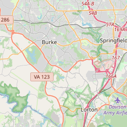
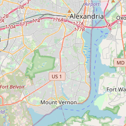
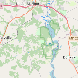
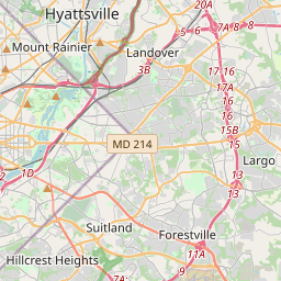
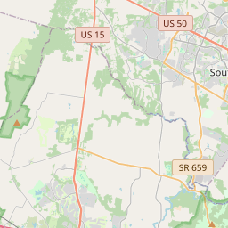
| Closest Postal Address | At or near 18830-18884 Lake Accotink Trail, West Springfield VA 22152, US |
| Alternative Maps | Google Maps, MapQuest, Bing Maps, Yahoo Maps, MSR Maps, OpenCycleMap, MyTopo Maps, OpenStreetMap |
Is this marker missing? Are the coordinates wrong? Do you have additional information that you would like to share with us? If so, check in.
Nearby Markersshow on map
Show me all markers in: West Springfield, VA | Fairfax County | 22152 | Virginia | United States of America
Maintenance Issues
- Is this marker part of a series?
- What historical period does the marker represent?
- What historical place does the marker represent?
- What type of marker is it?
- What class is the marker?
- What style is the marker?
- Does the marker have a number?
- What year was the marker erected?
- Who or what organization placed the marker?
- This marker needs at least one picture.
- Can this marker be seen from the road?
- Is the marker in the median?
Comments 0 comments