Inscription
Trails of the Bear Mountain - Harriman Parks
Bear Mountain - Harriman State Park's trail system is an extensive web of paths, trails and old roads that satisfy the hiker seeking natural beauty and a quiet escape. While the best known of these is the Appalachian Trail, within the 80-square-mile area of the Bear Mountain - Harriman State Parks and set amid the scenic Hudson Highlands, lies a network of hundreds of miles of marked trails of great variety.
[ Sidebars : ]
New York - New Jersey Trail Conference
In addition to providing the public with over 1,700 miles of hiking trails on the bi-state region, the New York - New Jersey Trail Conference, a federation of 100 hiking and outdoor clubs with 10,000 individual members, is concerned with trail land protection and education. Originally established in 1920 to voluntarily construct and maintain the hiking trails of the Palisades Interstate Park Commission. In 1923, the NY-NJ Trail Conference, in cooperation with the Commission built the section of the Appalachian Trail here in Bear Mountain - Harriman State Park. The Conference continues to manage the Appalachian Trail in New York and New Jersey. Over the years, in cooperation with park authorities, over 370 miles of Conference foot trails have been built on PIPC lands alone. Today, the partnership with the Palisades Interstate Park Commission continues.
The Local Geology
The trails pass through 1.3 billion years of geological history within the Bear Mountain-Harriman State Parks. A major continental collision 1.1 billion years ago heated and compressed virtually all of the visible rocks here into banded gneisses. About 850 million years ago, fault and fracture action created large magnetite iron ore bodies. These were extensively mined during the 18th and 19th century occupation of the area. During the next 650 million years, the rocks of the Park were uplifted as mountain ranges, and eroded several times. Over the past 2 million years, erosion was greatly accelerated by huge mile thick ice sheets that scraped and removed all of the surface material and leveled the large mountain that once stood atop these rocks. The last glacier retreated about 12,000 years ago, leaving u-shaped valleys, bare hilltops, erratics, pot-holes, boulder fields, large swamps and the Hudson River, actually a fjord with its bed over 100 feet below sea level in many places.
Below an aerial photo of the tower:
Perkins Tower
A new road, constructed by hand in 1932 by the Civil Work Administration, traveled up to the top of Bear Mountain. The road provides access to this stone tower built in honor of George W. Perkins, Sr., first president of the Palisades Interstate Park Commission. It affords and excellent view of the Hudson Highlands and beyond.
Trail Ethics
Treat the land the trails cross and its neighbors with respect and care. Keep to the trails' defined footway. Leave your campsite cleaner than you found it. By leaving little or no trace of your presence, you help preserve the trails for future enjoyment. And remember: millions of hours have been donated by volunteers to build and maintain these trails, most at their own expense.
Major William A. Welch
Appointed in 1912 as the Palisades Interstate Park Commission's General Manager and Chief Landscape Engineer, Major William A. Welch designed the bush and forested environments of the Park. An innovator in public-private partnerships, Major Welch was one of the co-founders of the New York-New Jersey Trail Conference, acting for 10 years as that organization's first chairman. In 1925, he also chaired the newly organized Appalachian Trail Conference. Helping to establish natural and state park systems throughout the country, Major Welch founded and served as the first president of the National Council of State Parks.
Next to an aerial photo of the Island:
Iona Island
This scenic salt marsh island has had a variety of uses throughout its history. In the 18th century, this strategic venue centered the independence struggle in the Hudson Highlands. The propagation of the Iona Grape turned the island into the earliest and best known Hudson Valley vineyard of the 19th century. Later in the century, thousands of river excursionists journeyed to the Iona Island summer resort. Sold to the United States Government in the 20th century, the Island's superior Hudson River location distinguished it as a major naval ammunition depot during both world wars. The Palisades Interstate Park assumed jurisdiction over Iona Island in 1966, focusing on its importance as a wildlife and bird center.
Details
| HM Number | HM10CP |
|---|---|
| Tags | |
| Marker Condition | No reports yet |
| Date Added | Saturday, September 20th, 2014 at 4:32pm PDT -07:00 |
Pictures
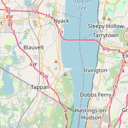
Locationbig map

| UTM (WGS84 Datum) | 18T E 589226 N 4542402 |
|---|---|
| Decimal Degrees | 41.02795000, -73.93861667 |
| Degrees and Decimal Minutes | N 41° 1.677', W 73° 56.317' |
| Degrees, Minutes and Seconds | 41° 1' 40.62" N, 73° 56' 19.02" W |
| Driving Directions | Google Maps |
| Area Code(s) | 201, 845, 212 |
| Closest Postal Address | At or near 1389-1699 New York State Reference Rte 987C, Tappan NY 10983, US |
| Alternative Maps | Google Maps, MapQuest, Bing Maps, Yahoo Maps, MSR Maps, OpenCycleMap, MyTopo Maps, OpenStreetMap |
Is this marker missing? Are the coordinates wrong? Do you have additional information that you would like to share with us? If so, check in.
Nearby Markersshow on map
The Palisades Interstate Parkway Scenic Byway Corridor
Tappan Historic District
Tappan Historic District
Joseph B. Clarke Rail Trail
Sparkill Veterans Monument, a War Memorial
Sparkill Veterans Memorial, a War Memorial
Sparkill Korean War Monument, a War Memorial
Sparkill Viet-Nam War Monument, a War Memorial
Sparkill World War I Memorial, a War Memorial
Tappan Historic District
Maintenance Issues
- Is this marker part of a series?
- What historical period does the marker represent?
- What historical place does the marker represent?
- What type of marker is it?
- What class is the marker?
- What style is the marker?
- Does the marker have a number?
- What year was the marker erected?
- Who or what organization placed the marker?
- This marker needs at least one picture.
- Can this marker be seen from the road?
- Is the marker in the median?
Comments 0 comments