The City that Disappeared
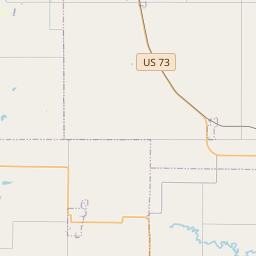
Near here, located in a grove of young hickory trees, was an important rallying point in 1855 and 1856 for members of The Church of Jesus Christ of Latter-Day Saints (Mormon), then emigrating to the Rocky Mountains.The campground, really a temporary village covering about 150 acres, consisted of the grove, a large pasture fenced by native sod and a ditch, and a burial ground located on the elevated ridge between the grove and the farm. Though one or two permanent structures were erected, most residents lived in tents, wagon boxes or make-shift dwellings.
During the peak year of emigration at Mormon Grove in 1855, nearly 2,000 Latter-Day Saints with 337 wagons left here for the Salt Lake Valley. It was also a tragic year for the U.S., British, and European Mormons at the little way station, many dying in a cholera epidemic.
In 1856, Iowa City, Iowa, became the major jump-off point for Latter-Day Saint westward travel, and Mormon Grove became a forgotten gathering place.
| HM Number | HM11G7 |
|---|---|
| Series | This marker is part of the Kansas: Kansas Historical Society series, and the Mormon Pioneer Trail series. |
| Tags | |
| Marker Number | 117 |
| Placed By | Church of Jesus Christ of Later-day Saints and Kansas Historical Society |
| Marker Condition | No reports yet |
| Date Added | Wednesday, October 8th, 2014 at 4:59pm PDT -07:00 |


| UTM (WGS84 Datum) | 15S E 311142 N 4380920 |
|---|---|
| Decimal Degrees | 39.55720000, -95.19825000 |
| Degrees and Decimal Minutes | N 39° 33.432', W 95° 11.895' |
| Degrees, Minutes and Seconds | 39° 33' 25.92" N, 95° 11' 53.70" W |
| Driving Directions | Google Maps |
| Area Code(s) | 913, 785 |
| Closest Postal Address | At or near 7369-7699 Osage Rd, Atchison KS 66002, US |
| Alternative Maps | Google Maps, MapQuest, Bing Maps, Yahoo Maps, MSR Maps, OpenCycleMap, MyTopo Maps, OpenStreetMap |
Is this marker missing? Are the coordinates wrong? Do you have additional information that you would like to share with us? If so, check in.
- What historical period does the marker represent?
- What historical place does the marker represent?
- What type of marker is it?
- What class is the marker?
- What style is the marker?
- What year was the marker erected?
- This marker could use another picture or two.
- Can this marker be seen from the road?
- Is the marker in the median?


Comments 0 comments