Inscription
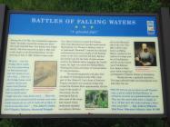
"A splendid falls"
During the Civil War, the strategically important Valley Turnpike crossed the stream just above the small waterfall here. Two battles were fought nearby. The first occurred on July 2, 1861, half a mile south on the Porterfield Farm. On the morning of July 2, 1861, Federal troops under General Robert Patterson crossed the Potomac River from Maryland and marched south toward Martinsburg. Colonel Thomas J. Jackson (soon to be nicknamed "Stonewall") ordered his command northward from the town, fought a brief delaying action on the farm, and then fell back. Because this stream was the last body of water encountered by the Federals before engaging the Confederates, the fight was named for Falling Waters, following the Union convention of naming battles for natural features.The second engagement took place after the Battle of Gettysburg in July 1863, when part of General Robert E. Lee's Army of Northern Virginia retreated over a pontoon bridge that crossed the Potomac River approximately 150 feet south of the mouth of this stream. On the morning of July 14, after most of the troops had crossed, Union cavalrymen attacked two infantry divisions still on the Maryland side of the river. This fight, which is also known as Falling Waters, resulted in the capture of a large number of Confederates and the mortal wounding of Confederate General James J. Pettigrew, whose troops had participated in Pickett's Charge in Gettysburg.
During the war, a gristmill stood here. The large railroad bridge and embankment were built after the war.
"Well I'll tell you we are down in old Virginie near a place called Falling Waters, so called on account of a splendid falls nearby. They say the water falls from a height of 45 or 50 feet over the rocks making a beautiful waterfall." - Seargent Andrew Malseed, twenty third Penn. Volunteer Infantry, June 19, 1861
Details
| HM Number | HM13EL |
|---|---|
| Series | This marker is part of the West Virginia Civil War Trails series |
| Tags | |
| Placed By | West Virginia Civil War Trails |
| Marker Condition |           7 out of 10 (1 reports) |
| Date Added | Sunday, September 21st, 2014 at 1:15pm PDT -07:00 |
Pictures
Locationbig map
| UTM (WGS84 Datum) | 18S E 251867 N 4382863 |
|---|---|
| Decimal Degrees | 39.55960000, -77.88820000 |
| Degrees and Decimal Minutes | N 39° 33.576', W 77° 53.292' |
| Degrees, Minutes and Seconds | 39° 33' 34.56" N, 77° 53' 17.52" W |
| Driving Directions | Google Maps |
| Area Code(s) | 304 |
| Closest Postal Address | At or near 17-19 Co Rte 11/16, Falling Waters WV 25419, US |
| Alternative Maps | Google Maps, MapQuest, Bing Maps, Yahoo Maps, MSR Maps, OpenCycleMap, MyTopo Maps, OpenStreetMap |
Is this marker missing? Are the coordinates wrong? Do you have additional information that you would like to share with us? If so, check in.
Nearby Markersshow on map
Show me all markers in: Falling Waters, WV | Berkeley County | 25419 | West Virginia | United States of America
Maintenance Issues
- What historical period does the marker represent?
- What historical place does the marker represent?
- What type of marker is it?
- What class is the marker?
- What style is the marker?
- Does the marker have a number?
- What year was the marker erected?
- This marker could use another picture or two.
- Can this marker be seen from the road?
- Is the marker in the median?

Comments 0 comments