Inscription
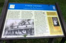
Confederate and Union Headquarters
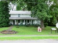
During his and Gen. Henry Alexander Wise's unsuccessful Kanawha Valley campaign, Confederate Gen. John B. Floyd made his headquarters here, August 17-18, 1861, while Wise camped on the top of Big Sewell Mountain. In 1862, according to an inscription carved over the front door, the tavern was "Headquarters of the Chicago Gray Dragoons". The original Chicago Dragoons enlisted in April 1861 for three months and were sent to West Virginia in June. Most of the men returned to Chicago when their enlistments expired, but their captain, Charles W. Barker, recruited two companies called the McClellan Dragoons. After November 1862, they became Cos. H and I, 12 Illinois Volunteer Cavalry. Besides serving as a headquarters for both sides during the war, according to local tradition, the Tyree Tavern also served as a hospital.William Tyree, the owner of the tavern, was captain of Co. C, 22nd Regiment Virginia Infantry (CS), also known as the 1st Kanawha Regiment. Two of his sons, Andrew and Joseph Tyree, served in his company. The regiment was organized in July 1861 and saw action at Carnifex Ferry and Droop Mountain. It took part in many of the battles in the Shenandoah Valley of Virginia before disbanding in the spring of 1865.
(Top Sidebar): Thomas J. Jackson, later nicknamed Stonewall, stayed here in August 1855, hoping to visit his mother's grave in Westlake Cemetery. William Tyree, who had attended her burial, took him there. However, the grave was unmarked, and Jackson was not sure he saw the spot.
(Lower Sidebar): This building may be the oldest structure standing in Fayette County. Charles Skaggs received a patent for 400 acres here in 1792, and his sons Joseph Skaggs may have built the earliest portion then. George Hunter bought the property later then sold it to William Tyree in 1834. Located midway between Charleston and Lewisburg on the James River and Kanawha Turnpike, the tavern was sometimes called the Halfway House. As recently as 1927, the wife of Tyree's son Joseph operated the tavern. It is a private residence today.
Details
| HM Number | HM14PN |
|---|---|
| Series | This marker is part of the West Virginia Civil War Trails series |
| Tags | |
| Placed By | West Virginia Civil War Trails |
| Marker Condition | No reports yet |
| Date Added | Friday, September 19th, 2014 at 1:42pm PDT -07:00 |
Pictures
Photo Credits: [1] DARYL SKAGGS [2] DARYL SKAGGS [3] DARYL SKAGGS [4] DARYL SKAGGS
Locationbig map
| UTM (WGS84 Datum) | 17S E 491709 N 4220764 |
|---|---|
| Decimal Degrees | 38.13470000, -81.09460000 |
| Degrees and Decimal Minutes | N 38° 8.082', W 81° 5.676' |
| Degrees, Minutes and Seconds | 38° 8' 4.92" N, 81° 5' 40.56" W |
| Driving Directions | Google Maps |
| Area Code(s) | 304 |
| Closest Postal Address | At or near 23 Tyree St, Ansted WV 25812, US |
| Alternative Maps | Google Maps, MapQuest, Bing Maps, Yahoo Maps, MSR Maps, OpenCycleMap, MyTopo Maps, OpenStreetMap |
Is this marker missing? Are the coordinates wrong? Do you have additional information that you would like to share with us? If so, check in.
Nearby Markersshow on map
Maintenance Issues
- What historical period does the marker represent?
- What historical place does the marker represent?
- What type of marker is it?
- What class is the marker?
- What style is the marker?
- Does the marker have a number?
- What year was the marker erected?
- Can this marker be seen from the road?
- Is the marker in the median?


Comments 0 comments