Inscription
(obverse)
Col. Robert Patterson (1753-1827)
A large landholder, Patterson took part in founding Lexington, Cincinnati and Dayton. Chose site of Lexington, helped erect fort, April 1779, and laid off town; on Board of Trustees for many years. He helped charter Transylvania Univ. Urged separation from Va., 1784; elected representative from Fayette County, 1792, and served eight years. Moved to Dayton, 1803.
(reverse)
Patterson Cabin
Built by Robert Patterson prior to his marriage in April 1780, to Elizabeth Lindsay, this small cabin has been a home, servant's quarters and tool shed. It has had many sites, including original on Cane Run; farm of Patterson's grandson, Dayton, Ohio, 1901-1939; and several on Transylvania campus. Returned to Lexington by request of Kentucky, this city and D.A.R.
Details
| HM Number | HM15IJ |
|---|---|
| Series | This marker is part of the Kentucky: Kentucky Historical Society series |
| Tags | |
| Marker Number | 1613 |
| Year Placed | 1977 |
| Placed By | Kentucky Historical Society, Kentucky Department of Highways |
| Marker Condition | No reports yet |
| Date Added | Wednesday, October 1st, 2014 at 7:55am PDT -07:00 |
Pictures
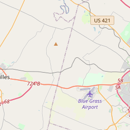
Locationbig map


| UTM (WGS84 Datum) | 16S E 719807 N 4214514 |
|---|---|
| Decimal Degrees | 38.05170000, -84.49485000 |
| Degrees and Decimal Minutes | N 38° 3.102', W 84° 29.691' |
| Degrees, Minutes and Seconds | 38° 3' 6.12" N, 84° 29' 41.46" W |
| Driving Directions | Google Maps |
| Area Code(s) | 707 |
| Closest Postal Address | At or near 217-299 W 3rd St, Lexington KY 95485, US |
| Alternative Maps | Google Maps, MapQuest, Bing Maps, Yahoo Maps, MSR Maps, OpenCycleMap, MyTopo Maps, OpenStreetMap |
Is this marker missing? Are the coordinates wrong? Do you have additional information that you would like to share with us? If so, check in.
Nearby Markersshow on map
Show me all markers in: Lexington, KY | Fayette County | 95485 | Kentucky | United States of America
Maintenance Issues
- What historical period does the marker represent?
- What historical place does the marker represent?
- What type of marker is it?
- What class is the marker?
- What style is the marker?
- This marker needs at least one picture.
- Can this marker be seen from the road?
- Is the marker in the median?

Comments 0 comments