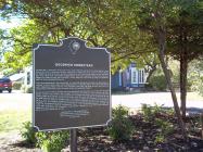
Inscription
In 1843 Ira C. Goodrich purchased this land from the United States Government. As an early settler to McHenry County, Goodrich founded the local school system, served as director and was road master. Farmsteads like this established by the early settlers set the stage for gentlemen farms where land use changed from agriculture for profit to agriculture for pleasure. Horse breeding and riding became an important part of life in Barrington Hills.
This site represents the evolution of land and buildings originally homesteaded in 1843 as traditional farm to its adaptation of a leisure farm in 1926 and is one of the last remaining from this era. The property includes the road on what was once an Indian trail providing early settlers entry into McHenry County.
In 1926 Chicago Tribune owner and philanthropist Alfred Cowles Jr. came here with his sons, Alfred 3rd, Knight and Thomas to enjoy this farm as their country retreat. Cowles was an attorney, Civic Federation and Bureau Efficiency president and director of Continental Bank of Chicago. The family created a Yale University foundation in 1928 with a gift of $350,000. Alfred Cowles 3rd was an American economist, an author and founder of the Cowles Commission for Economics, serving as president from 1932 to 1939. The headquarters was at the University of Chicago, but moved to Yale University in 1955 and renamed Cowles Foundation. Today, the foundation provides funding for research and study of economics. Subsequent owners of Plum Tree Farm continued with leisure farming activities.
Details
| HM Number | HM18K5 |
|---|---|
| Series | This marker is part of the Illinois: Illinois State Historical Society series |
| Tags | |
| Year Placed | 2012 |
| Placed By | The Duresa Family, the Barrington History Museum,and the Illinois State Historical Society |
| Marker Condition | No reports yet |
| Date Added | Wednesday, September 17th, 2014 at 6:20pm PDT -07:00 |
Pictures
Locationbig map
| UTM (WGS84 Datum) | 16T E 399407 N 4670844 |
|---|---|
| Decimal Degrees | 42.18328333, -88.21811667 |
| Degrees and Decimal Minutes | N 42° 10.997', W 88° 13.087' |
| Degrees, Minutes and Seconds | 42° 10' 59.82" N, 88° 13' 5.22" W |
| Driving Directions | Google Maps |
| Area Code(s) | 847, 630, 312, 224 |
| Closest Postal Address | At or near 1001 Plumtree Rd, Barrington IL 60010, US |
| Alternative Maps | Google Maps, MapQuest, Bing Maps, Yahoo Maps, MSR Maps, OpenCycleMap, MyTopo Maps, OpenStreetMap |
Is this marker missing? Are the coordinates wrong? Do you have additional information that you would like to share with us? If so, check in.
Nearby Markersshow on map
Show me all markers in: Barrington, IL | McHenry County | 60010 | Illinois | United States of America
Maintenance Issues
- What historical period does the marker represent?
- What historical place does the marker represent?
- What type of marker is it?
- What class is the marker?
- What style is the marker?
- Does the marker have a number?
- This marker could use another picture or two.
- Can this marker be seen from the road?
- Is the marker in the median?

Comments 0 comments