Inscription
Erected in 1833, the President's House served as the home of Professor Samuel S. Schmucker during his long tenure at the Seminary. Runaway slaves reportedly received aid and temporary shelter in a nearby barn before they continued on their journey farther north. Schmucker wrote and preached against slavery:
"God has of one blood created all nations to dwell on the face of the earth, has endowed them all with certain unalienable rights and obligations, such as life, liberty, and the pursuit of happiness. All who fail to labor for the extinction of slavery, are guilty of sin." When Confederate troops marched towards Pennsylvania in June 1863, Schmucker learned that the approaching Southerners planned to arrest him. He suspended classes and fled to York, Pennsylvania. Upon returning to his home after the battle, he received a great shock. "The house I occupy was most damaged," reported Samuel, "Thirteen cannon balls or shells pierced the walls...and everything...in my house, broken open by the rebels, and the contents scattered promiscuously with my books, papers, letters, etc."
Some evidence remains. Note the artillery projectile embedded in the south wall of the house directly in front of you.
Details
| HM Number | HM19D6 |
|---|---|
| Series | This marker is part of the Pennsylvania: Seminary Ridge Historic Walking Tour series |
| Tags | |
| Year Placed | 2013 |
| Placed By | The Seminary Ridge Historic Preservation Foundation |
| Marker Condition | No reports yet |
| Date Added | Thursday, October 16th, 2014 at 11:15am PDT -07:00 |
Pictures
Locationbig map

| UTM (WGS84 Datum) | 18S E 307972 N 4411363 |
|---|---|
| Decimal Degrees | 39.83058333, -77.24398333 |
| Degrees and Decimal Minutes | N 39° 49.835', W 77° 14.639' |
| Degrees, Minutes and Seconds | 39° 49' 50.10" N, 77° 14' 38.34" W |
| Driving Directions | Google Maps |
| Area Code(s) | 717 |
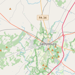
| Closest Postal Address | At or near 321-399 Springs Ave, Gettysburg PA 17325, US |
| Alternative Maps | Google Maps, MapQuest, Bing Maps, Yahoo Maps, MSR Maps, OpenCycleMap, MyTopo Maps, OpenStreetMap |
Is this marker missing? Are the coordinates wrong? Do you have additional information that you would like to share with us? If so, check in.
Nearby Markersshow on map
Show me all markers in: Gettysburg, PA | Adams County | 17325 | Pennsylvania | United States of America
Dance's Battalion - First Virginia Artillery
Samuel Simon Schmucker
Daniel Alexander Payne
Cunningham's Battery - Dance's Battalion
Valentine Hall
Co. D. 149th Pennsylvania Volunteers
Life as a Seminary Student
Gettysburg Seminary Ridge Museum
Crisis Comes to the Seminary's Back Door
Samuel Simon Schmucker Hall
Maintenance Issues
- What historical period does the marker represent?
- What historical place does the marker represent?
- What type of marker is it?
- What class is the marker?
- What style is the marker?
- Does the marker have a number?
- This marker needs at least one picture.
- Can this marker be seen from the road?
- Is the marker in the median?
Comments 0 comments