Inscription
Battling for Control of the Niagara
Strategic ImportanceWhen European explorers reached the Great Lakes, they realized that passage up the Niagara River would unlock routes to the west. Traveling by water from the lakes, they could reach the Ohio and Mississippi Rivers, and even access the Gulf of Mexico. Controlling the river meant controlling access to trade routes into the continent's interior.
1. Spring 1813 - A combined force of naval ships and American infantry units attack Fort George. Commodore Isaac Chauncey commands the naval forces, and Oliver Hazard Perry volunteers to command one of the ships. Colonel Winfield Scott leads the infantry assault.
2. The British garrison of regulars, Grand River warriors, and militia resist stubbornly along the lakeshore.
3. British General John Vincent, fearing that he would be cutoff and surrounded, orders a retreat toward Burlington Heights, a strategic British position at the west end of Lake Ontario.
4. Summer 1813 - American forces engage in a summer long campaign to capture Burlington Heights, but fail.
5. Short on men and supplies, with winter setting in, American General George McClure orders Newark and Fort George to be burned and retreats to Fort Niagara.
6. Winter 1813 - British General Gordon Drummond vows revenge through "sword and fire" for the destruction of Newark, and orders a British attack across the Niagara River to capture Fort Niagara.
7. Colonel John Murray and about 550 British soldiers land at Five Mile Meadow and attack Fort Niagara. Resistance is quickly overcome and by 5am, the fort is in British hands.
Within Range
The British built Fort George on the Canadian side of the Niagara River when they withdrew from Fort Niagara in 1796. The two forts were within cannon range of each other and both sides fired cannonballs at the other.
Fort George was built on higher ground, giving the British the early advantage when bombarding the Americans.
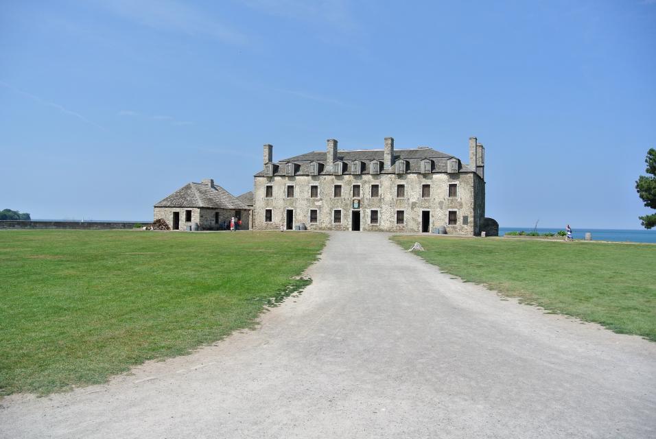
The American garrison responded by removing the roofs from the two redoubts and the Mess House (French Castle) and moving the cannons to the upper floors to gain the height advantage.
Betsy Doyle
Betsy Doyle was the wife of a private in the American Artillery who had been captured during the battle of Queenston Heights. Betsy was present at Fort Niagara when an exchange of cannon fire began, she joined the action by helping to prepare "hot shot" for the cannon firing from "on the mess house." Her heroic action was compared to Joan of Arc in the days that followed.
Hot shot was prepared by heating cannon balls until they were cherry red. When they lodged into a ship or wooden building they would quickly set it afire.
Cross-Border Exchanges
1812
October 13
American forces under the command of Major General Stephen van Rensselaer briefly seize Queenston Heights before being driven back across the river. Fort George and Fort Niagara exchange artillery fire.
November 21
Following the American's failed invasion of Upper Canada, gunners at Fort George and Fort Niagara exchange cannon fire throughout the day,
1813
April 27
Combined American naval and land forces attack and burn York (Toronto), the capital of Upper Canada. American General Zebulon Pike is killed attacking Fort York.
May 26
The guns at Fort Niagara aid in Winfield Scott's landing and capture of Fort George.
December 10
Americans burn Newark and Fort George.
December 19
British attacks seize Fort Niagara and destroy Lewiston and Youngstown.
December 21
British raids burn Manchester (Niagara Falls) and Fort Schlosser.
1814
July 24
British forces cross the Niagara and drive American guards from Lewiston.
1815
May 22
American troops re-occupy Fort Niagara.
Details
| HM Number | HM19YL |
|---|---|
| Tags | |
| Placed By | Seaway Trail, Inc |
| Marker Condition | No reports yet |
| Date Added | Sunday, September 14th, 2014 at 3:04am PDT -07:00 |
Pictures

Locationbig map
| UTM (WGS84 Datum) | 17T E 657410 N 4791786 |
|---|---|
| Decimal Degrees | 43.26245000, -79.06053333 |
| Degrees and Decimal Minutes | N 43° 15.747', W 79° 3.632' |
| Degrees, Minutes and Seconds | 43° 15' 44.82" N, 79° 3' 37.92" W |
| Driving Directions | Google Maps |
| Area Code(s) | 716 |
| Closest Postal Address | At or near 11 Scott Ave, Youngstown NY 14174, US |
| Alternative Maps | Google Maps, MapQuest, Bing Maps, Yahoo Maps, MSR Maps, OpenCycleMap, MyTopo Maps, OpenStreetMap |
Is this marker missing? Are the coordinates wrong? Do you have additional information that you would like to share with us? If so, check in.
Nearby Markersshow on map
Show me all markers in: Youngstown, NY | Niagara County | 14174 | New York | United States of America
Maintenance Issues
- Is this marker part of a series?
- What historical period does the marker represent?
- What historical place does the marker represent?
- What type of marker is it?
- What class is the marker?
- What style is the marker?
- Does the marker have a number?
- What year was the marker erected?
- Can this marker be seen from the road?
- Is the marker in the median?
Comments 0 comments