Inscription
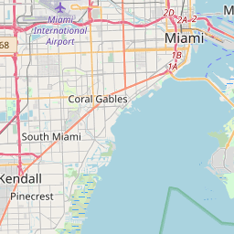
The town of Peters, no longer recognized, was named after the "Tomato King," Thomas J. Peters, who moved to this area in 1895. His tomato growing and packing business was the area's first million dollar enterprise and Peters was the area's first "company town." The center of the town of Peters was situated about three blocks south of here on the west side of US1, in the vicinity of Quail Roost Drive. The Peters' residence was located east of US1, in the area now known as Bel Aire. Unfortunately, all remnants of the town of Peters were lost in Hurricane Andrew in 1992.
Thomas J. Peters and his family were major contributors to the founding of the Perrine-Peters United Methodist Church. The church was named for the settlements founded by the Perrine and Peters families. Dr. Henry Perrine and his family received the original grant for the land in 1838, founding what is still known as the town of Perrine. In 1916, the first sanctuary was built on the Perrine-Peters border, east of the railroad tracks. This structure was destroyed in the 1926 hurricane. Eventually outgrowing its subsequent facilities, the congregation broke ground for the present church in 1958. This marker was presented by the extended Peters family on the centennial of the Perrine-Peters United Methodist Church, March 26, 2000.
Thomas J. Peters and his family were major contributors to the founding of the Perrine-Peters United Methodist Church. The church was named for the settlements founded by the Perrine and Peters families. Dr. Henry Perrine and his family received the original grant for the land in 1838, founding what is still known as the town of Perrine. In 1916, the first sanctuary was built on the Perrine-Peters border, east of the railroad tracks. This structure was destroyed in the 1926 hurricane. Eventually outgrowing its subsequent facilities, the congregation broke ground for the present church in 1958. This marker was presented by the extended Peters family on the centennial of the Perrine-Peters United Methodist Church, March 26, 2000.
Details
| HM Number | HM1CY4 |
|---|---|
| Tags | |
| Year Placed | 2000 |
| Placed By | The Historical Association of Southern Florida |
| Marker Condition | No reports yet |
| Date Added | Thursday, October 2nd, 2014 at 7:57am PDT -07:00 |
Pictures
Locationbig map


| UTM (WGS84 Datum) | 17R E 564966 N 2831601 |
|---|---|
| Decimal Degrees | 25.60050000, -80.35301667 |
| Degrees and Decimal Minutes | N 25° 36.03', W 80° 21.181' |
| Degrees, Minutes and Seconds | 25° 36' 1.80" N, 80° 21' 10.86" W |
| Driving Directions | Google Maps |
| Area Code(s) | 305, 786 |
| Closest Postal Address | At or near 18301 S Dixie Hwy, Palmetto Bay FL 33157, US |
| Alternative Maps | Google Maps, MapQuest, Bing Maps, Yahoo Maps, MSR Maps, OpenCycleMap, MyTopo Maps, OpenStreetMap |
Is this marker missing? Are the coordinates wrong? Do you have additional information that you would like to share with us? If so, check in.
Nearby Markersshow on map
Show me all markers in: Palmetto Bay, FL | Miami-Dade County | 33157 | Florida | United States of America
Maintenance Issues
- Is this marker part of a series?
- What historical period does the marker represent?
- What historical place does the marker represent?
- What type of marker is it?
- What class is the marker?
- What style is the marker?
- Does the marker have a number?
- This marker needs at least one picture.
- Can this marker be seen from the road?
- Is the marker in the median?

Comments 0 comments