Inscription
The discovery of the outcrop of the Sunbeam Lode and the subsequent organization of the Tintic Mining District on December 13, 1869, was the beginning of a mining district which ultimately became world-famous. The name is in honor of the Ute Indian Chief Tintic who roamed this area with his braves. This district survives as the best physical reminder of Utah's mining heritage. Towns include Eureka, Silver City, Diamond, Knightsville, and Homansville. Gold, silver, lead, and copper were the primary minerals of the region.
There were four railroad companies serving the mining district: the Salt Lake and Western Railway, the Tintic Range Railway, the New East Tintic Railway, and the narrow gauge Eureka Hill Railway.
Eureka came to be known as one of the quietest boom camps in the west. There were stores, theaters, hotels, schools, newspapers, churches, an Andrew Carnegie library, and one of the first Golden Rule ( J.C. Penney ) stores.
There was a diverse ethnic mix in the district. The camps consisted of people representing many nationalities and religions, the famous and notorious, miners, prospectors, business proprietors, doctors, teachers, cowboys, railroad men, and beloved women. These women rocked the cradle, nursed the sick, and waited at the mouth of the mines to know who was being brought up from the bowels of the earth below. The women dressed the dead and knelt in prayer. To all who believed tomorrow would bring a better life, we pay honor. Today we stand together and remember the great heroes of yesterday who settled this district with a dream of a better tomorrow.
Details
| HM Number | HM1FBH |
|---|---|
| Series | This marker is part of the Daughters of Utah Pioneers series |
| Tags | |
| Marker Number | 512 |
| Year Placed | 1998 |
| Placed By | Sunbeam Camp, Daughters of Utah Pioneers. |
| Marker Condition | No reports yet |
| Date Added | Sunday, September 7th, 2014 at 6:03pm PDT -07:00 |
Pictures
Locationbig map


| UTM (WGS84 Datum) | 12S E 405275 N 4423871 |
|---|---|
| Decimal Degrees | 39.95968333, -112.10905000 |
| Degrees and Decimal Minutes | N 39° 57.581', W 112° 6.543' |
| Degrees, Minutes and Seconds | 39° 57' 34.86" N, 112° 6' 32.58" W |
| Driving Directions | Google Maps |
| Area Code(s) | 435, 801 |
| Which side of the road? | Marker is on the right when traveling South |
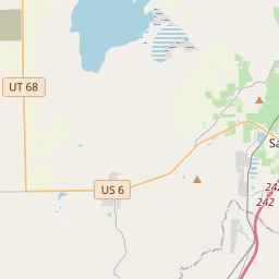
| Closest Postal Address | At or near 100 Terrace Heights Rd, Eureka UT 84628, US |
| Alternative Maps | Google Maps, MapQuest, Bing Maps, Yahoo Maps, MSR Maps, OpenCycleMap, MyTopo Maps, OpenStreetMap |
Is this marker missing? Are the coordinates wrong? Do you have additional information that you would like to share with us? If so, check in.
Nearby Markersshow on map
Maintenance Issues
- What historical period does the marker represent?
- What historical place does the marker represent?
- What type of marker is it?
- What class is the marker?
- What style is the marker?
- This marker needs at least one picture.
- Can this marker be seen from the road?
- Is the marker in the median?
Comments 0 comments