Inscription
(1801-1886)
Reverend Brown was the first African American Methodist minister in Vermont. He was born in Newport, RI and became a Methodist minister in Kingsbury, NY in 1833. He made a living by building stone walls; many of which are still standing today. Brown served as a missionary to Liberia from 1837-1843. In 1855 he organized Methodist classes in Wolcott and supervised the building of the church in 1856. As far as can be determined this is the only church he served in the United States as the preacher in charge. He died in Glens Falls, NY.
Details
| HM Number | HM1GYI |
|---|---|
| Tags | |
| Year Placed | 2011 |
| Placed By | Vermont Division for Historic Preservation |
| Marker Condition | No reports yet |
| Date Added | Friday, October 10th, 2014 at 2:02pm PDT -07:00 |
Pictures
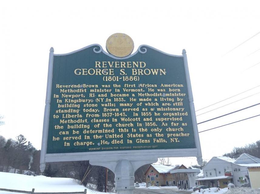
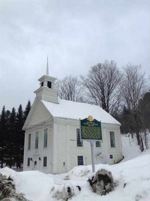
Photo Credits: [1] STEPHEN M. DICK [2] STEPHEN M. DICK
Locationbig map
| UTM (WGS84 Datum) | 18T E 701562 N 4935878 |
|---|---|
| Decimal Degrees | 44.54805000, -72.46248333 |
| Degrees and Decimal Minutes | N 44° 32.883', W 72° 27.749' |
| Degrees, Minutes and Seconds | 44° 32' 52.98" N, 72° 27' 44.94" W |
| Driving Directions | Google Maps |
| Area Code(s) | 585 |
| Which side of the road? | Marker is on the right when traveling West |
| Closest Postal Address | At or near 1855-1861 Co Rd 12, Wolcott VT 14013, US |
| Alternative Maps | Google Maps, MapQuest, Bing Maps, Yahoo Maps, MSR Maps, OpenCycleMap, MyTopo Maps, OpenStreetMap |
Is this marker missing? Are the coordinates wrong? Do you have additional information that you would like to share with us? If so, check in.
Nearby Markersshow on map
Maintenance Issues
- Is this marker part of a series?
- What historical period does the marker represent?
- What historical place does the marker represent?
- What type of marker is it?
- What class is the marker?
- What style is the marker?
- Does the marker have a number?
- This marker could use another picture or two.
- Can this marker be seen from the road?
- Is the marker in the median?
Comments 0 comments