Inscription
Natural Stream to Storm Drain
The stone-lined channel that plunges over the bluff edge below you was once a free-flowing water course. Today it is a partially abandoned segment of the city's storm drain system drawing in run-off from West State Street and a handful of buildings and properties in the vicinity of the New Jersey State House. Downstream from this point, just beyond the arch of the West Front Street Bridge, the run connects to a much larger and more active drain that passes beneath the Old Barracks and heads down to the Delaware River at the mouth of the Assunpink Creek. Upstream, Petty's Run is contained within a culvert that extends for more than 300 feet almost to Willow Street.
A Ravine Behind the Barracks
Before industrial and urban development, Petty's Run (named fr the Pettit family that settled here around 1700) drained an area of perhaps five square miles, gathering water from several small tributaries. The stream, fast-flowing after heavy rains, was substantial enough to serve as a barrier to the western expansion of the colonial town. Here, behind the Old Barracks, Petty's Run descended the bluff edge bordering the Delaware in a steep ravine.
In the bed of the run at other locations within the archaeological site can be seen the tough gneiss bedrock, formed more than a billion years ago. This material, along with the younger Wissahickon schist, underlies much of downtown Trenton and gives form to the "falls of the Delaware." In colonial and early federal times, these rocks were quarried and used as building stone, including here on this very site.
Water for Power
At this point in the landscape, Petty's Run drops down more than 20 feet in a horizontal distance of around 80 feet. From the early 1730s until the 1870s this break in slope allowed the energy of flowing and falling water to be harnessed for a variety of industrial purposes. A dam and millpond delivered water power to the 18th-century mills at this spot.
Further upstream, Petty's Run supplied water to a pair of tanneries and a brewery, and also powered a bark mill, all during the colonial period. Early in the 19th century the stream was channelized and the culvert's stone sidewalls were built; around the same time springs along Petty's Run in the Pennington Avenue area were tapped for the growing city's first water supply system.
The construction of the Delaware and Raritan Feeder Canal in the early 1830s reduced the amount of water in the run, necessitating agreements between the canal company and downstream water users to ensure an adequate flow, supplemented as needed with water from the canal itself.
Hazardous to the Public Health
By the 1870s, Petty's Run was notorious for its filthy, noxious waters and recognized as a health risk. Residents, merchants and hoteliers routinely dumped waste into the creek, adding to the pollution already caused by the tanneries and other industrial water users. Around this time, in an effort to control the pollution, much of the stream in the downtown was progressively covered over with a brick-vaulted arch set on top of the channel's stone sidewalls.
In the late 1880s and early 1890s, Trenton built a city-wide sewer system, designed by sanitary engineer Rudolph Hering, which incorporated the flow of Petty's Run and led to the isolation of the storm drain segment between West Front Street and Willow Street. The creation of Mahlon Stacy Park in 1914-16 resulted in the deeper burial of the Petty's Run culvert beneath several feet of landscaping fill, rendering the run largely inaccessible until its archaeological rediscovery in the mid-1980s.
Details
| HM Number | HM1HJU |
|---|---|
| Tags | |
| Marker Condition | No reports yet |
| Date Added | Thursday, October 30th, 2014 at 9:04am PDT -07:00 |
Pictures
Locationbig map

| UTM (WGS84 Datum) | 18T E 519647 N 4452214 |
|---|---|
| Decimal Degrees | 40.22011667, -74.76908333 |
| Degrees and Decimal Minutes | N 40° 13.207', W 74° 46.145' |
| Degrees, Minutes and Seconds | 40° 13' 12.42" N, 74° 46' 8.7" W |
| Driving Directions | Google Maps |
| Area Code(s) | 609 |
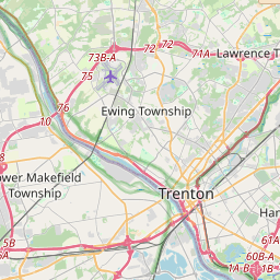
| Closest Postal Address | At or near 11000-11470 Wilson St, Trenton NJ 08608, US |
| Alternative Maps | Google Maps, MapQuest, Bing Maps, Yahoo Maps, MSR Maps, OpenCycleMap, MyTopo Maps, OpenStreetMap |
Is this marker missing? Are the coordinates wrong? Do you have additional information that you would like to share with us? If so, check in.
Nearby Markersshow on map
Maintenance Issues
- Is this marker part of a series?
- What historical period does the marker represent?
- What historical place does the marker represent?
- What type of marker is it?
- What class is the marker?
- What style is the marker?
- Does the marker have a number?
- What year was the marker erected?
- Who or what organization placed the marker?
- This marker needs at least one picture.
- Can this marker be seen from the road?
- Is the marker in the median?
Comments 0 comments