Inscription
Important Habitat Complex
— Natural History —
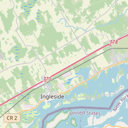
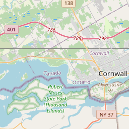
This Wildlife Management Area (WMA) is a 3,400 acre multi-use area where the habitat is managed to provide food and shelter for dabbling and diving ducks, Canada geese and other waterbirds, as well as upland game birds and mammals. While much of the area is designated as a "Refuge" and is therefore off limits to public access, there are opportunities here for hunting, trapping, birdwatching, photography and nature study in designated areas. Specific regulations apply to all activities, so be sure to check before entering the area. The Lower Saint Lawrence River The stretch of the St. Lawrence River from Morristown to Massena contains a variety of upland and wetlands habitats that shelter a high diversity of bird species. The quality of this habitat is especially evident during the spring and fall when the river and its adjoining wetland habitats serve as staging areas for a wide variety of waterfowl and other birds. Due to its importance in safeguarding and enhancing bird populations, this area has been designated as an Important Bird Area by the National Audubon Society and the NYS Department of Environmental Conservation, respectively. The Lower St. Lawrence Important Bird Area (IBA)Stretching from Morristown to the Moses-Saunders Dam, a distance of approximately 50 miles, the Lower St. Lawrence River IBA encompasses a range of wetland and upland habitats. Bald Eagle, Haliaeetus leucocephalus, Wingspan-80". Many eagles winter along the river near Ogdensburg. Common Merganser, Mergus merganser, Wingspan-34". Up to 10,000 winter near Long Sault Dam. Bank Swallow, Riparia riparia, Wingspan-13". One of the largest colonies in the world is located near Sparrowhawk Point, 3,000 pairs. Canada Goose, Branta canadensis, Wingspan-60" Common Tern, Sterna hirundo, Wingspan-30". American Bittern, Botaurus lentiginosus, Wingspan-42". The WMA was acquired by the New York State Power Authority (NYPA) for the St. Lawrence FDR Power Project in the early 1950s. Following that, it as developed under cooperative agreement between NYPA and the New York State Department of Environmental Conservation (DEC)(then called the Conservation Department), primarily for waterfowl habitat enhancement. Under this agreement NYPA holds title to the land, while DEC is charged with managing it for fish and wildlife. This cooperative agreement between NYPA and DEC is still in effect. These three species of duck are taken by hunters in the greatest numbers.Green-winged Teal, Anas crecca, Wingspan-23" Mallard, Anas platyrhynchos, Wingspan-35". Ring-necked Duck, Aythya collaris, Wingspan-25". The Annual Wilson Hill Goose DriveEvery summer DEC wildlife staff teams up with sportsmen and women and local residents to conduct a goose drive at the Wilson Hill WMA. The purpose is to gather biological data on resident Canada Geese. It is also an opportunity to promote communications regarding the conservation and management of waterfowl and to foster community relations. More than 1,000 geese are rounded up each year. As many as 200 people help in the effort, both in canoes and on land, to herd the molting birds into a corral where they can be captured, banded and released. The information obtained helps track the movements of these geese, providing data that is used in management practices. Recreation opportunities related to wildlife are abundant and varied along the Seaway Trail. Seaway Trail, Inc., Corner Ray & West Main St., Sackets Harbor, NY 13685. 1-800-SEAWAY-T. America's Byways. This exhibit made possible by a grant from FHWA to Seaway Trail, Inc.Details
| HM Number | HM1I56 |
|---|---|
| Tags | |
| Marker Condition | No reports yet |
| Date Added | Wednesday, December 3rd, 2014 at 9:03am PST -08:00 |
Pictures
Locationbig map


| UTM (WGS84 Datum) | 18T E 498787 N 4974300 |
|---|---|
| Decimal Degrees | 44.92213333, -75.01536667 |
| Degrees and Decimal Minutes | N 44° 55.328', W 75° 0.922' |
| Degrees, Minutes and Seconds | 44° 55' 19.68" N, 75° 0' 55.32" W |
| Driving Directions | Google Maps |
| Area Code(s) | 315 |
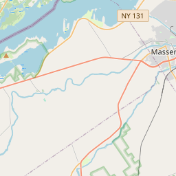
| Closest Postal Address | At or near 261-279 NY-131, Massena NY 13662, US |
| Alternative Maps | Google Maps, MapQuest, Bing Maps, Yahoo Maps, MSR Maps, OpenCycleMap, MyTopo Maps, OpenStreetMap |
Is this marker missing? Are the coordinates wrong? Do you have additional information that you would like to share with us? If so, check in.
Nearby Markersshow on map
Show me all markers in: Massena, NY | St. Lawrence County | 13662 | New York | United States of America
St. Lawrence River and Massena
Battle of Crysler's Farm
Battle of Crysler's Farm 1813
Battlefield of Crysler's Farm
Loyalist American Regiments / Loyalists of the Indian Nations / Sir John Johnson
Holstein Friesian Cattle in Ontario
Aultsville Train Station and Locomotive 1008
Sir James Pliny Whitney
The Rev. Johann Samuel Schwerdtfeger
In Memory of Those Who Made the Supreme Sacrifice
Maintenance Issues
- Is this marker part of a series?
- What historical period does the marker represent?
- What historical place does the marker represent?
- What type of marker is it?
- What class is the marker?
- What style is the marker?
- Does the marker have a number?
- What year was the marker erected?
- Who or what organization placed the marker?
- This marker needs at least one picture.
- Can this marker be seen from the road?
- Is the marker in the median?
Comments 0 comments