Inscription
Saunders County was originally Oto Indian territory, and a large earthlodge village under Chief Itan was located here during the early historic period. Later, the Pawnee established villages in the area and in 1855 held peace conferences with General John M. Thayer.
The Ox-Bow Trail, the primary route from Nebraska City to Fort Kearny in 1845-1859, passed through this area. Pioneers first settled here in 1856 and 1857. The county's organization was approved in 1867 and the county seat located at Ashland. Wahoo was surveyed three years later and became the county seat in 1873. The origin of the name "Wahoo" is uncertain, but it is probably derived from an Oto word.
In 1883 Swedish settlers in Wahoo established a school which eventually became Luther Junior College. When Luther merged with Midland College in Fremont, the Wahoo campus was sold. In 1965 it became the site of John F. Kennedy College.
Among Wahoo's prominent native sons are artist Clarence W. Anderson, geneticist and Nobel Prize winner George Beadle, baseball player "Wahoo Sam" Crawford, composer Howard Hanson and motion picture producer Darryl F. Zanuck.
Wahoo Lions Club
Historical Land Mark Council
US 30 A & 77, Wahoo
Saunders County
Marker 82
Details
| HM Number | HM1IXB |
|---|---|
| Series | This marker is part of the Nebraska: Nebraska State Historical Society series |
| Tags | |
| Marker Number | 82 |
| Placed By | Wahoo Lions Club; Historical Land Mark Council |
| Marker Condition | No reports yet |
| Date Added | Friday, January 23rd, 2015 at 1:01pm PST -08:00 |
Pictures
Locationbig map


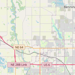

| UTM (WGS84 Datum) | 14T E 699296 N 4564738 |
|---|---|
| Decimal Degrees | 41.20950000, -96.62283333 |
| Degrees and Decimal Minutes | N 41° 12.57', W 96° 37.37' |
| Degrees, Minutes and Seconds | 41° 12' 34.2" N, 96° 37' 22.2" W |
| Driving Directions | Google Maps |
| Area Code(s) | 402 |
| Which side of the road? | Marker is on the right when traveling South |
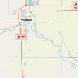
| Closest Postal Address | At or near 399-493 US-77, Wahoo NE 68066, US |
| Alternative Maps | Google Maps, MapQuest, Bing Maps, Yahoo Maps, MSR Maps, OpenCycleMap, MyTopo Maps, OpenStreetMap |
Is this marker missing? Are the coordinates wrong? Do you have additional information that you would like to share with us? If so, check in.
Nearby Markersshow on map
Maintenance Issues
- What historical period does the marker represent?
- What historical place does the marker represent?
- What type of marker is it?
- What class is the marker?
- What style is the marker?
- What year was the marker erected?
- This marker needs at least one picture.
- Can this marker be seen from the road?
- Is the marker in the median?
Comments 0 comments