Inscription
Railroad Construction in Texas, interrupted by the civil war and the national economic depression of the early1870s, began a period of recovery int he late 1870s and early 1880s. Chartered on May 31, 1879 the Texas Central Railway was owned by the Houston and Texas Central Railways and was in competition with the Texas Pacific to build a line westward thought north central Texas.
Extending from Ross Station near Waco in 1879, the Texas Central Reached the Erath-Comanche County Line in 1880. The Texas Central laid out the town of De Leon on April 10, 1881. And Railroad official Robert M. Elgin conducted the sale of town lots from the back of a flatcar on July 7. Although the initial sale of lots was slow, the town soon developed and attracted new settlers from the southeaster united States. Railroad offices, shops, and roundhouse were build here and he De Leon becomes the ares's primary shipping point for cotton and , later, peanuts and other products.
Acquired by the Missouri-Kansas -Texas-Katy Railroad in 1910, the line continued to operate until 1967 when local backers purchased part of the line and continued to provide shipping service to customers along "the Peanut Line" connecting Dublin, De Leon, and Gorman.
Details
| HM Number | HM1O2V |
|---|---|
| Tags | |
| Historical Period | 19th Century |
| Historical Place | Train |
| Marker Type | Historic Building |
| Marker Class | Historical Marker |
| Marker Style | Free Standing |
| Year Placed | 1994 |
| Placed By | Texas Historical Comission |
| Marker Condition | No reports yet |
| Date Added | Monday, September 21st, 2015 at 9:33pm PDT -07:00 |
Pictures

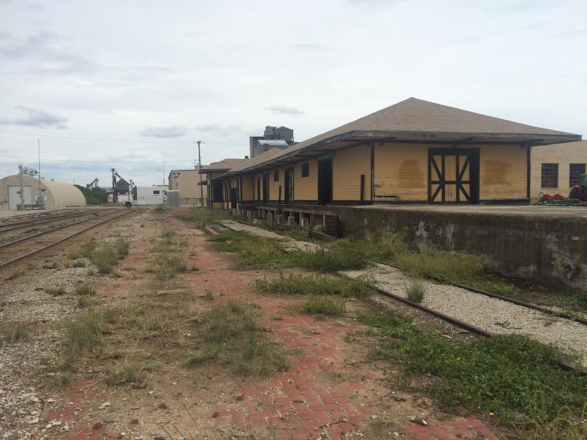

Photo Credits: [1] REX LEWIS FIELD [2] REX LEWIS FIELD
Locationbig map
| Directions Information | The marker is right beside the train tracks to right when heading south on TX 16. |
|---|---|
| UTM (WGS84 Datum) | 14S E 543736 N 3552859 |
| Decimal Degrees | 32.11123800, -98.53640200 |
| Degrees and Decimal Minutes | N 32° 6.6743', W 98° 32.1841' |
| Degrees, Minutes and Seconds | 32° 6' 40.4568" N, 98° 32' 11.0472" W |
| Driving Directions | Google Maps |
| Area Code(s) | 254 |
| Can be seen from road? | Yes |
| Is marker in the median? | No |
| Which side of the road? | Marker is on the right when traveling South |
| Closest Postal Address | At or near 101-355 W Almante St, De Leon TX 76444, US |
| Alternative Maps | Google Maps, MapQuest, Bing Maps, Yahoo Maps, MSR Maps, OpenCycleMap, MyTopo Maps, OpenStreetMap |
Is this marker missing? Are the coordinates wrong? Do you have additional information that you would like to share with us? If so, check in.
Nearby Markersshow on map
Maintenance Issues
- Is this marker part of a series?
Comments 0 comments