Inscription
1906
—Lower Downtown Walking Tour —
On the original site of the Washington Hotel and Studebaker Buggy and Carriage House, this building was constructed in 1906 as a four-story warehouse for the Spratlen-Anderson Mercantile Co. Frank Edbrooke designed the original structure, as well as a two-story addition built in 1919. He used his characteristic paired arched windows divided by roundels, a style he also employed in the seventh story of his famed Brown Palace Hotel. The building was completed towards the end of Edbrooke's career and reveals his transition to a simpler, more sober and refined style, characteristic of post-silver crash architecture. The Spratlen Mercantile Warehouse was purchased in 1923 by the Davis Brothers Drug Company. Davis moved to Denver from Rawlings, Wyoming and purchased the firm in 1901. He died tragically in a railroad crash in 1909, but his sons and grandsons went on to build Davis Brothers into a large wholesale drug firm.Details
| HM Number | HM1U42 |
|---|---|
| Tags | |
| Placed By | The Lower Downtown Historic District |
| Marker Condition | No reports yet |
| Date Added | Saturday, September 3rd, 2016 at 1:01pm PDT -07:00 |
Pictures
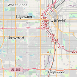
Locationbig map


| UTM (WGS84 Datum) | 13S E 499815 N 4400100 |
|---|---|
| Decimal Degrees | 39.75081667, -105.00215000 |
| Degrees and Decimal Minutes | N 39° 45.049', W 105° 0.129' |
| Degrees, Minutes and Seconds | 39° 45' 2.94" N, 105° 0' 7.74" W |
| Driving Directions | Google Maps |
| Area Code(s) | 303, 720 |
| Which side of the road? | Marker is on the right when traveling South |
| Closest Postal Address | At or near 1450 Wynkoop St, Denver CO 80202, US |
| Alternative Maps | Google Maps, MapQuest, Bing Maps, Yahoo Maps, MSR Maps, OpenCycleMap, MyTopo Maps, OpenStreetMap |
Is this marker missing? Are the coordinates wrong? Do you have additional information that you would like to share with us? If so, check in.
Nearby Markersshow on map
Maintenance Issues
- Is this marker part of a series?
- What historical period does the marker represent?
- What historical place does the marker represent?
- What type of marker is it?
- What class is the marker?
- What style is the marker?
- Does the marker have a number?
- What year was the marker erected?
- This marker needs at least one picture.
- Can this marker be seen from the road?
- Is the marker in the median?

Comments 0 comments