Inscription
In November 1862, Col. Albert Lee's cavalry and Gen. Charles Hamilton's infantry division led the Union advance down the Mississipi Central R.R. Here, at Lumpkin's Mill, Lee's men met Col. William H. Jackson's Confederate cavalry. After a spirited fight on November 29, Jackson fell back to the Tallahatchie River line, pursued by Lee. Hamilton's division camped here. The next day, Pemberton's Confederate army withdrew to the Yalobusha River, and Grant moved his headquarters to Waterford, 1 mile south.
Pictures
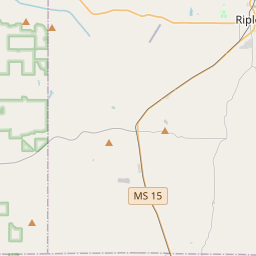
Locationbig map


| UTM (WGS84 Datum) | 16S E 274517 N 3838643 |
|---|---|
| Decimal Degrees | 34.66495000, -89.46073333 |
| Degrees and Decimal Minutes | N 34° 39.897', W 89° 27.644' |
| Degrees, Minutes and Seconds | 34° 39' 53.82" N, 89° 27' 38.64" W |
| Driving Directions | Google Maps |
| Area Code(s) | 662 |
| Which side of the road? | Marker is on the right when traveling South |
| Closest Postal Address | At or near 3735 MS-7, Holly Springs MS 38635, US |
| Alternative Maps | Google Maps, MapQuest, Bing Maps, Yahoo Maps, MSR Maps, OpenCycleMap, MyTopo Maps, OpenStreetMap |
Is this marker missing? Are the coordinates wrong? Do you have additional information that you would like to share with us? If so, check in.
Nearby Markersshow on map
Show me all markers in: Holly Springs, MS | Marshall County | 38635 | Mississippi | United States of America
Maintenance Issues
- What historical period does the marker represent?
- What historical place does the marker represent?
- What type of marker is it?
- What class is the marker?
- What style is the marker?
- Does the marker have a number?
- This marker needs at least one picture.
- Can this marker be seen from the road?
- Is the marker in the median?
Comments 0 comments