Inscription
Side ASince its 1902 founding, the Michigan Manufacturers association has dealt with many important business issues. Beginning in 1908, the MMA organized employers to establish a system for compensating injured workers. In 1912, based on a proposal authored by the MMA, Michigan's first Workers Compensation Act became law. In 1943. the Michigan Manufacturers Association became the first such association in the nation to offer group insurance programs to its members.Side BIn 1902 the Michigan Manufacturers Association (MMA) held its first meeting in the chamber of the Michigan House of Representatives. The MMA is a voluntary, non-profit organization dedicated to promoting the welfare of Michigan industry and providing information to manufacturers about such ongoing concerns as taxation, workers' compensation and unemployment insurance. In 1952 the MMA established an office in Lansing so that constant contact with the legislative process could be maintained.
Details
| HM Number | HM1YS3 |
|---|---|
| Series | This marker is part of the Michigan: Michigan Historical Commission series |
| Tags | |
| Year Placed | 1987 |
| Placed By | Bureau of History, Michigan Department of State |
| Marker Condition | No reports yet |
| Date Added | Tuesday, June 6th, 2017 at 9:04pm PDT -07:00 |
Pictures
Locationbig map


| UTM (WGS84 Datum) | 16T E 700250 N 4733411 |
|---|---|
| Decimal Degrees | 42.72710000, -84.55405000 |
| Degrees and Decimal Minutes | N 42° 43.626', W 84° 33.243' |
| Degrees, Minutes and Seconds | 42° 43' 37.56" N, 84° 33' 14.58" W |
| Driving Directions | Google Maps |
| Area Code(s) | 517, 989 |
| Which side of the road? | Marker is on the right when traveling South |
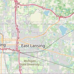
| Closest Postal Address | At or near 600-620 S Capitol Ave, Lansing MI 48933, US |
| Alternative Maps | Google Maps, MapQuest, Bing Maps, Yahoo Maps, MSR Maps, OpenCycleMap, MyTopo Maps, OpenStreetMap |
Is this marker missing? Are the coordinates wrong? Do you have additional information that you would like to share with us? If so, check in.
Nearby Markersshow on map
Maintenance Issues
- What historical period does the marker represent?
- What historical place does the marker represent?
- What type of marker is it?
- What class is the marker?
- What style is the marker?
- Does the marker have a number?
- This marker needs at least one picture.
- Can this marker be seen from the road?
- Is the marker in the median?
Comments 0 comments