Inscription
The succession of outposts here, remote from centers of New
World empire, symbolized a dream of the imperial age: to
connect the Gulf of Mexico to North America's vast interior
by the great rivers that drained it.
Following British victory in the French and Indian War
France—in 1762—ceded Louisiana to her ally, Spain. Fearing
Great Britain's designs on the Mississippi, the Spaniards took
command of the Post of Arkansas, later called Fort Carlos IIl,
and retained many of the French traders and soldiers. During
the American Revolution, Spanish offensives against the British
in Florida and on the Mississippi River aided the patriotic cause.
At the very end of that war-in 1783—a partisan band led by
former British Captain James Colbert attacked Fort Carlos.
The Spanish-French garrison and community fought them off
Names of some of the soldiers, settlers, and militia who lived
at the Post of Arkansas before, during, and after the Colbert
Raid are presented below:
Joseph Barthelemy · Jean Baptiste Imbeau (father)
Antoine Beauvais · Joseph Imbeau
Anselme Billet dit Lajuenesse · Pierre Jardelas
Michel Bonne (father) · Stanislas LeVasseur
Michel Bonne (son) · Andres Lopez
Louis Boulard · Francois Menard
Peter Clausin · Marie Messager
Francois
Cousott · Louis Perthuis dit Lajanvry
Jean Baptiste Dardenne · Pierre Perthuis dit Chevalier
Jean Baptiste Duchassin · Antoine Pinot
Andre Fagot · Joseph Stillwell
Jean Baptiste Grabert · Louis Souligny le Duc
(father) · Charles de Vilemont
Jean Baptiste Grabert (son)
Three Nations Converge: Both land and water approaches were used by France, Spain, and Great Britain while contending for control of this region.
[Map caption]
France, Spain, and Great Britain contended for the junction of the Mississippi and Arkansas Rivers — gateway to Indian trade, key to control of the rivers.
Details
| HM Number | HM21RR |
|---|---|
| Tags | |
| Placed By | National Park Service, Department of Interior |
| Marker Condition | No reports yet |
| Date Added | Monday, September 18th, 2017 at 10:01pm PDT -07:00 |
Pictures
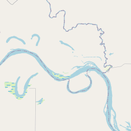
Locationbig map

| UTM (WGS84 Datum) | 15S E 652820 N 3765287 |
|---|---|
| Decimal Degrees | 34.01710000, -91.34491667 |
| Degrees and Decimal Minutes | N 34° 1.026', W 91° 20.695' |
| Degrees, Minutes and Seconds | 34° 1' 1.56" N, 91° 20' 41.7" W |
| Driving Directions | Google Maps |
| Area Code(s) | 870 |
| Closest Postal Address | At or near 1623B Old Post Rd, Gillett AR 72055, US |
| Alternative Maps | Google Maps, MapQuest, Bing Maps, Yahoo Maps, MSR Maps, OpenCycleMap, MyTopo Maps, OpenStreetMap |
Is this marker missing? Are the coordinates wrong? Do you have additional information that you would like to share with us? If so, check in.
Nearby Markersshow on map
Maintenance Issues
- Is this marker part of a series?
- What historical period does the marker represent?
- What historical place does the marker represent?
- What type of marker is it?
- What class is the marker?
- What style is the marker?
- Does the marker have a number?
- What year was the marker erected?
- This marker needs at least one picture.
- Can this marker be seen from the road?
- Is the marker in the median?
Comments 0 comments