Inscription
by the
National Society United States Daughters of 1812
of
North Carolina
Memorial to North Carolina Militia, stationed at Deepwater Point, about one mile northeast of Southport on the water front, several companies of major John A. Lillington's detachment July - December 1812: the Brunswick Regiment (Moore's) July - August 1813: Several Companies of Major John A. Cameron's command September 1813 - January 1814
Mary Louisa Jackson Cooper, State President Ettie Brown, State Chairman.
Details
| HM Number | HM259R |
|---|---|
| Tags | |
| Year Placed | 1938 |
| Placed By | National Society United States Daughters of 1812 of North Carolina |
| Marker Condition | No reports yet |
| Date Added | Monday, February 5th, 2018 at 10:02am PST -08:00 |
Pictures
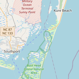
Locationbig map


| UTM (WGS84 Datum) | 17S E 775810 N 3757050 |
|---|---|
| Decimal Degrees | 33.91780000, -78.01673333 |
| Degrees and Decimal Minutes | N 33° 55.068', W 78° 1.004' |
| Degrees, Minutes and Seconds | 33° 55' 4.0799999999999" N, 78° 1' 0.24" W |
| Driving Directions | Google Maps |
| Area Code(s) | 910 |
| Closest Postal Address | At or near 203 E Bay St, Southport NC 28461, US |
| Alternative Maps | Google Maps, MapQuest, Bing Maps, Yahoo Maps, MSR Maps, OpenCycleMap, MyTopo Maps, OpenStreetMap |
Is this marker missing? Are the coordinates wrong? Do you have additional information that you would like to share with us? If so, check in.
Nearby Markersshow on map
Maintenance Issues
- Is this marker part of a series?
- What historical period does the marker represent?
- What historical place does the marker represent?
- What type of marker is it?
- What class is the marker?
- What style is the marker?
- Does the marker have a number?
- This marker needs at least one picture.
- Can this marker be seen from the road?
- Is the marker in the median?
Comments 0 comments