Inscription
—Antietam Campaign 1862 —
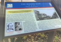
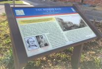
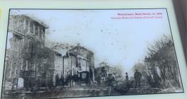
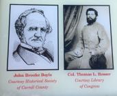
After Confederate Gen. Robert E. Lee's smashing victory over Union Gen. John Pope at the Second Battle of Manassas, Lee decided to invade Maryland to reap the fall harvest, gain Confederate recruits, earn foreign recognition of the Confederacy, and perhaps compel the Union to sue for peace. The Army of the Northern Virginia crossed the Potomac River on September 4, 1862. Lee divided his force, detaching Gen. Thomas J. "Stonewall" Jackson's corps to capture Harpers Ferry. At Antietam Creek on September 17, Gen. George B. McClellan's Army of the Potomac fought Lee's men to a bloody draw. Lee retreated to Virginia September 18-19.In the early evening darkness of September 11, 1862, Confederate Col. Thomas L. Rosser, 5th Virginia Cavalry, led several hundred cavalrymen on a sudden and unexpected raid into Westminster. Rosser and his men had departed from New Market early in the morning. They rode into Westminster on Liberty Street, then known as Goose Pond Lane. Artillery Capt. James Breathed, a Maryland native, accompanied the cavalrymen with one cannon. During the occupation of Westminster, the gun was positioned in the fork of West Main Street and Pennsylvania avenue facing the railroad.
The Southern-sympathizing townspeople greeted the troopers warmly, and the cavalier colonel was the center of attention. Graciously, he gave the gushing citizens tokens of remembrance including uniform buttons, signatures, and hairs cut from his horse's mane. Rosser had captured the steed from Union Gen. John Pope a few weeks earlier.
Col. John Brooke Boyle welcomed Rosser and his staff into his home for dinner with his family. The stately residence served as Rosser's headquarters for the night. The rest of Rosser's command bivouacked on John Street. The Odd Fellows Hall at 140 East Main Street, which was serving as the armory for the Carroll Guards Militia, was broken into during the night and the contents vandalized. The next day, the Confederates rode out of Westminster in the direction of South Mountain.
Boyle's house is known as Rosser's Choice to this day.
Details
| HM Number | HM25O4 |
|---|---|
| Series | This marker is part of the Maryland Civil War Trails series |
| Tags | |
| Historical Period | 19th Century, Civil War |
| Historical Place | Military Installation, Town |
| Marker Type | Historic District |
| Marker Class | Historical Marker |
| Marker Style | Free Standing |
| Placed By | Maryland Civil War Trails |
| Marker Condition | No reports yet |
| Date Added | Monday, February 26th, 2018 at 10:01am PST -08:00 |
Pictures
Photo Credits: [1] SEPTEMBERSPARROW1666 [2] SEPTEMBERSPARROW1666 [3] SEPTEMBERSPARROW1666 [4] SEPTEMBERSPARROW1666 [5] SEPTEMBERSPARROW1666
Locationbig map
| UTM (WGS84 Datum) | 18S E 328395 N 4382726 |
|---|---|
| Decimal Degrees | 39.57708333, -76.99801667 |
| Degrees and Decimal Minutes | N 39° 34.625', W 76° 59.881' |
| Degrees, Minutes and Seconds | 39° 34' 37.5000" N, 76° 59' 52.8600" W |
| Driving Directions | Google Maps |
| Area Code(s) | 410 |
| Can be seen from road? | Yes |
| Is marker in the median? | No |
| Which side of the road? | Marker is on the right when traveling South |
| Closest Postal Address | At or near 73B W Main St, Westminster MD 21157, US |
| Alternative Maps | Google Maps, MapQuest, Bing Maps, Yahoo Maps, MSR Maps, OpenCycleMap, MyTopo Maps, OpenStreetMap |
Is this marker missing? Are the coordinates wrong? Do you have additional information that you would like to share with us? If so, check in.
Nearby Markersshow on map
Show me all markers in: Westminster, MD | Carroll County | 21157 | Maryland | United States of America


Comments 0 comments