Inscription
Located on the corner of Coll Street and Magazine Avenue, the Emmie Seele Faust Memorial Library served as the New Braunfels public library from 1938 to 1969. The New Braunfels Library Association formed in 1928 to meet the need for better education in the growing community. For ten years, the association operated a public library at various locations around the downtown area. In 1937, Emmie Seele Faust (1867-1957), daughter of first New Braunfels teacher, Hermann Seele, spearheaded a combined effort between the City of New Braunfels, the Sophienburg Museum and the New Braunfels Library Association to give the public library a permanent home.
The native rock building was designed by architect Jeremiah (Jimmie) Schmidt and opened in 1938 with 250 visitors. Built by Edwin Hanz, the rectangular, 65 x 30-foot building sits on a bell-shaped foundation made of rock and concrete. The front door and wrought-iron window grates are original.
When the Dittlinger Memorial Library was built in 1967 on the back of the property, the Emmie Seele Faust Library building ceased to be the public library, taking on a new use as an archive and artifact collection storage space for the Sophienburg Museum and Archives. The Dittlinger Memorial Library building became part of the Sophienburg in 1999. In 2010, the Emmie Seele Faust Library
was restored and repurposed as a meeting hall and classroom, preserving the original intention of the library association and Emmie Seele Faust.
Details
| HM Number | HM2FYU |
|---|---|
| Tags | |
| Year Placed | 2017 |
| Placed By | Texas Historical Commission |
| Marker Condition | No reports yet |
| Date Added | Thursday, April 25th, 2019 at 8:01am PDT -07:00 |
Pictures
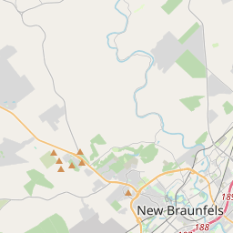
Locationbig map

| UTM (WGS84 Datum) | 14R E 584685 N 3285589 |
|---|---|
| Decimal Degrees | 29.69751667, -98.12461667 |
| Degrees and Decimal Minutes | N 29° 41.851', W 98° 7.477' |
| Degrees, Minutes and Seconds | 29° 41' 51.06" N, 98° 7' 28.62" W |
| Driving Directions | Google Maps |
| Which side of the road? | Marker is on the right when traveling North |
| Closest Postal Address | At or near , , |
| Alternative Maps | Google Maps, MapQuest, Bing Maps, Yahoo Maps, MSR Maps, OpenCycleMap, MyTopo Maps, OpenStreetMap |
Is this marker missing? Are the coordinates wrong? Do you have additional information that you would like to share with us? If so, check in.
Maintenance Issues
- What country is the marker located in?
- Is this marker part of a series?
- What historical period does the marker represent?
- What historical place does the marker represent?
- What type of marker is it?
- What class is the marker?
- What style is the marker?
- Does the marker have a number?
- This marker needs at least one picture.
- Can this marker be seen from the road?
- Is the marker in the median?
Comments 0 comments