Inscription
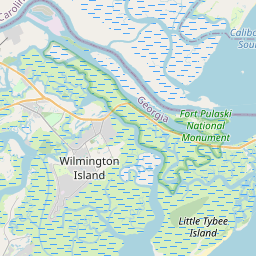
Fort Pulaski National Monument
In front of you, reaching to the North Channel, a busy village supported Fort Pulaski. Originally built to house workers constructing the fort, the village became an extension of the post. How people used village buildings changed over time. The image depicts the village as it was used in April 1862. A sutler store (similar to a general store), blacksmith, and bakery—all the shops and services found in a typical village of the day—were here. The military abandoned the site in 1880, and a hurricane destroyed the village in 1881.Details
| HM Number | HM2GZ1 |
|---|---|
| Tags | |
| Placed By | National Park Service, U.S. Department of the Interior |
| Marker Condition | No reports yet |
| Date Added | Monday, May 20th, 2019 at 11:01pm PDT -07:00 |
Pictures
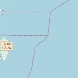
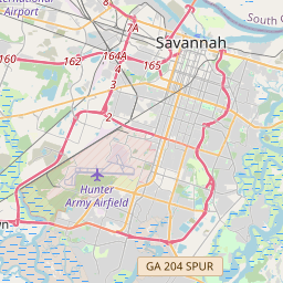
Locationbig map


| UTM (WGS84 Datum) | 17S E 510135 N 3543492 |
|---|---|
| Decimal Degrees | 32.02753333, -80.89266667 |
| Degrees and Decimal Minutes | N 32° 1.652', W 80° 53.56' |
| Degrees, Minutes and Seconds | 32° 1' 39.12" N, 80° 53' 33.6" W |
| Driving Directions | Google Maps |
| Which side of the road? | Marker is on the right when traveling South |
| Closest Postal Address | At or near , , |
| Alternative Maps | Google Maps, MapQuest, Bing Maps, Yahoo Maps, MSR Maps, OpenCycleMap, MyTopo Maps, OpenStreetMap |
Is this marker missing? Are the coordinates wrong? Do you have additional information that you would like to share with us? If so, check in.
Maintenance Issues
- What country is the marker located in?
- Is this marker part of a series?
- What historical period does the marker represent?
- What historical place does the marker represent?
- What type of marker is it?
- What class is the marker?
- What style is the marker?
- Does the marker have a number?
- What year was the marker erected?
- This marker needs at least one picture.
- Can this marker be seen from the road?
- Is the marker in the median?
Comments 0 comments