Inscription
Picturing the Past
The shores of the Chesapeake Bay are the perfect place to watch the ebb and flow of the tides. Just as with the tides, the small town of North Beach has experimented many changes in its history.The town's original heyday began in the early 1900s as a resort town. By the 1920s, there was a thriving small, summer community with cottages, churches and shops. The commercial district was located at 3rd & Chesapeake Avenue. An early railway line stopped there making it convenient for passengers to enjoy arcades, legalized gambling, dance halls, bars, hotels, restaurants, bath houses and several guest houses.
There were many more businesses than those pictured here: a gasoline and automobile service station, feed store, well drilling company, post office, grocery stores, bakery, barber shop, shoe repair shop, gift store, bowling alley, bingo parlor and dance pavilion.
In addition to the thriving businesses along Chesapeake Avenue, locations at the intersection of Bay Avenue and 7th Street, known as Ewald's Corner, housed a dry goods store, grocery store, restaurant and bar. Interestingly, slot machines were found in nearly every type of establishment.
All of these early businesses and establishments were made possible because North Beach was part of the first area in Calvert County to receive electricity.
Four
major events changed the history of North Beach: the Chesapeake Bay Hurricane of 1933, the closing of the Chesapeake Beach Railway line in 1935, the opening of the Chesapeake Bay Bridge in 1952, and the repeal of legalized gambling in 1968.
North Beach revitalization began in the early years of the 21st century. Home ownership was on the rise and the town became a primary area for full-time residents. This boom was not to last long. In 2003 Hurricane Isabel dealt the town a devastating blow. The town's famous pier and boardwalk were badly damaged.
But as with tides, the town experienced a second resurgence in the early 2000s as a recreational area, supported by permanent residences, antique stores, boutiques, candy stores, beauty shops and craft stores. New community buildings have been constructed. Among them are the North Beach Senior Center, Town Center Senior Apartments, Boys & Girls Club, Bayside History Museum, a new boardwalk with a Welcome Center and a new "green" Town Hall. Construction has mixed the new while repurposing the old.
We hope you come back and visit our town —
[Captions:]
The North Beach Electric Railway ran from the Chesapeake Beach Railway Station northward for a mile and a quarter to 3rd Street & Chesapeake Avenue. It opened May 31, 1914 to transport people between the beaches. Electric current was supplied by a small steam generator located at the North Beach end of the line. From time to time this plant would break down and trips were missed causing inconvenience to lines' patrons. The electric trolley line operated for approximately four years.
The line was abandoned for a couple of years until the need for transporting passengers between the two beaches was recognized. A Fordson tractor was fitted with flanged wheels grooved to fit the track. This tractor on rails got a lot of publicity. Many Washington, D.C. newspapers had pictures of it and it made the December 1921 issue of Popular Mechanics Magazine.
The tractor-pulled trolley made three trips hourly between Chesapeake Beach and North Beach until about 1923 when it was finally abandoned and replaced by a bus line, the Chesapeake Beach Transit Company and later taken over by the Washington, Marlboro & Annapolis Motor Lines.
This location on the West side of Chesapeake Avenue between 2nd & 3rd Streets was originally a Sanitary Grocery. It was purchased in the 1930s by Robert S. Mead and housed a lumber and hardware store. This business supplied much of the lumber used in the construction of cottages built at the time. It was destroyed by the fire of December 1945.
Located on the corner of 3rd Street and Chesapeake Avenue, it had two entrances: one went to the Bar & Restaurant, the other to a lobby with three inside doors: the Post Office was located inside to the right and a barber shop to the left. A center door went to apartments on the second floor. It was a popular night spot in the 1940s and 1950s. In the early 1960s, the building was sold to Mr. & Mrs. Albert Glickfield (aka Pop Brown). Their son and wife started Marlo Funiture in Washington, D.C. and Pop Brown opened a Marlo's Furniture Company in this building.
This historic building, circa 1926, was once owned and operated by Dr. and Mrs. West, and was one of North Beach's early guest houses. Washingtonians were drawn to North Beach for its cool breezes and beach activities. For much of the last century, this large shaded guest house on Chesapeake Avenue at 7th Street served a multitude of bayside vacationers. Although the building has undergone several incarnations over the years, it retains its original ambiance.
This movie theater in the 1920s and 1930s later became Mack's Bar & Grill located along Chesapeake Avenue between 2nd & 3rd Streets. The fire of December 11, 1945 started in the apartment above the bar.
Located at the corner of 3rd Street and Chesapeake Avenue, this was the first pharmacy in Calvert County. It was destroyed by the fire of December 1945. It was owned by Dr. & Mrs. Parker. He died before the fire. She was still operating it when the fire occurred.
Details
| HM Number | HM2K3O |
|---|---|
| Tags | |
| Placed By | Town of North Beach Historic Preservation Commission, Maryland Heritage Area, Southern Maryland |
| Marker Condition | No reports yet |
| Date Added | Friday, August 30th, 2019 at 8:02pm PDT -07:00 |
Pictures
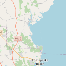
Locationbig map

| UTM (WGS84 Datum) | 18S E 366595 N 4285318 |
|---|---|
| Decimal Degrees | 38.70645000, -76.53425000 |
| Degrees and Decimal Minutes | N 38° 42.387', W 76° 32.055' |
| Degrees, Minutes and Seconds | 38° 42' 23.22" N, 76° 32' 3.3" W |
| Driving Directions | Google Maps |
| Which side of the road? | Marker is on the right when traveling West |
| Closest Postal Address | At or near , , |
| Alternative Maps | Google Maps, MapQuest, Bing Maps, Yahoo Maps, MSR Maps, OpenCycleMap, MyTopo Maps, OpenStreetMap |
Is this marker missing? Are the coordinates wrong? Do you have additional information that you would like to share with us? If so, check in.
Maintenance Issues
- What country is the marker located in?
- Is this marker part of a series?
- What historical period does the marker represent?
- What historical place does the marker represent?
- What type of marker is it?
- What class is the marker?
- What style is the marker?
- Does the marker have a number?
- What year was the marker erected?
- This marker needs at least one picture.
- Can this marker be seen from the road?
- Is the marker in the median?
Comments 0 comments