Inscription
Gold discoveries at Last Chance Gulch in 1864 brought a diverse population to the booming settlement of Helena. In 1870, Lewis and Clark County Commissioners established this ten-acre cemetery to serve the growing population. The first interments date to 1870. The historic road that borders the cemetery's east side, known as Benton Avenue, brought mourners and funeral processions from town. Benton Avenue became a convenient short-cut for lighter traffic off the main freighting routes and the Helena-Benton Road that entered town from North Main Street. Four simple quadrants divide the cemetery. Its central driveway is the original wagon road that led into the burial ground. Family plots dominate the southern half, outlined in stone curbing or wrought iron fencing. In 1872, the Masons purchased the northeast quadrant and most burials there have Masonic affiliations. The north west quadrant includes many unmarked graves, some of them unidentified reinterments from the city's first cemetery, the site of present-day Central School. Lewis and Clark County operated the cemetery from 1870 to 1922 when the Benton Avenue Cemetery Association incorporated and acquired the deed from the county. Benton Avenue Cemetery achieved listing in the National Register of Historic Places in 2003.
Details
| HM Number | HM2MCA |
|---|---|
| Tags | |
| Placed By | Montana Department of Transportation |
| Marker Condition | No reports yet |
| Date Added | Monday, October 28th, 2019 at 11:02am PDT -07:00 |
Pictures
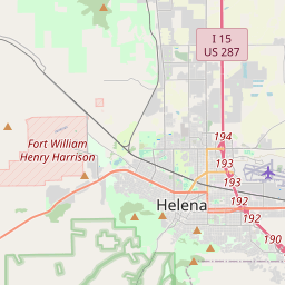
Locationbig map

| UTM (WGS84 Datum) | 12T E 420237 N 5161749 |
|---|---|
| Decimal Degrees | 46.60456667, -112.04150000 |
| Degrees and Decimal Minutes | N 46° 36.274', W 112° 2.49' |
| Degrees, Minutes and Seconds | 46° 36' 16.44" N, 112° 2' 29.4" W |
| Driving Directions | Google Maps |
| Which side of the road? | Marker is on the right when traveling South |
| Closest Postal Address | At or near , , |
| Alternative Maps | Google Maps, MapQuest, Bing Maps, Yahoo Maps, MSR Maps, OpenCycleMap, MyTopo Maps, OpenStreetMap |
Is this marker missing? Are the coordinates wrong? Do you have additional information that you would like to share with us? If so, check in.
Maintenance Issues
- What country is the marker located in?
- Is this marker part of a series?
- What historical period does the marker represent?
- What historical place does the marker represent?
- What type of marker is it?
- What class is the marker?
- What style is the marker?
- Does the marker have a number?
- What year was the marker erected?
- This marker needs at least one picture.
- Can this marker be seen from the road?
- Is the marker in the median?
Comments 0 comments