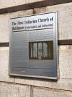
Inscription
(Unitarian and Universalist)
In 1817, when Baltimore Town boasted 60,000 inhabitants and Mount Vernon Place was still a forest, a group of leading citizens met in the home of Henry Payson "to form a religious society and build a church for Christians who are Unitarian and cherish liberal sentiments on the subject of religion." The name selected for the church, The First Unitarian Church of Baltimore was a precursor to the independence of thought and action that would become the hallmark of this group of free thinkers and succeeding generations. The name was changed to the current one in 1935, when the church merged with the Second Universalist Church.The Rev. Dr. William Ellery Channing delivered a landmark sermon here on May 5, 1819, at the ordination of the first minister, Jared Sparks. The sermon, defined the essence of Unitarianism in the United States and led to the formation of the denomination in 1824. This has come to be known as the Baltimore Sermon. Channing emphasized freedom, reason, and tolerance and taught that the way we live is more important than the words and symbols we use to describe our faith, a truth that has inspired a commitment to social justice with theological diversity.
Throughout its history, the church has been committed to community service. During the Civil War, the Reverend John F. W. Ware worked with abolitionists and tended to Union soldiers. He later organized and directed the Baltimore Association for the Moral and Intellectual Improvement of Colored People, which established over 200 schools for freed slaves. In 1874, the congregation organized Baltimore's first vocational school for teenagers. Distinguished members have included artist Rembrandt Peale, George Peabody, the founder of the Peabody Conservatory, Enoch Pratt, founder of Baltimore's free public library system, and Mary Richmond, a pioneer in the field of professional social work and philanthropy.
[photograph]
Built in 1818 by Maximilian Godefroy, The First Unitarian Church of Baltimore is recognized as the finest American example of French Romantic Classicism. A daring modern design when it was constructed, the building utilizes the basic shapes of the cube and the sphere with a minimum of detail on the flat planes to emphasize the geometry of the structure. It is the first building in North America built to be and used continuously as a Unitarian church. In the late 19th century, major reconstruction of the interior and sanctuary was undertaken, when a Tiffany mosaic and windows were added, as well as the magnificent Niemann organ.
Details
| HM Number | HM4E1 |
|---|---|
| Series | This marker is part of the Maryland: Baltimore City Historical Markers series |
| Tags | |
| Historical Period | 20th Century, 19th Century |
| Historical Place | National Natural Landmark, Church/House of Worship |
| Marker Type | Historic Building |
| Marker Class | Historical Marker |
| Marker Style | Mounted |
| Placed By | The City of Baltimore, William Donald Schaefer, mayor, rededicated 2008, Shiela Dixon, mayor |
| Marker Condition | No reports yet |
| Date Added | Tuesday, September 2nd, 2014 at 5:33pm PDT -07:00 |
Pictures
Locationbig map
| UTM (WGS84 Datum) | 18S E 360678 N 4350780 |
|---|---|
| Decimal Degrees | 39.29520000, -76.61563333 |
| Degrees and Decimal Minutes | N 39° 17.712', W 76° 36.938' |
| Degrees, Minutes and Seconds | 39° 17' 42.7200" N, 76° 36' 56.2800" W |
| Driving Directions | Google Maps |
| Area Code(s) | 410, 443, 301 |
| Can be seen from road? | Yes |
| Is marker in the median? | No |
| Which side of the road? | Marker is on the right when traveling West |
| Closest Postal Address | At or near 500-514 N Charles St, Baltimore MD 21201, US |
| Alternative Maps | Google Maps, MapQuest, Bing Maps, Yahoo Maps, MSR Maps, OpenCycleMap, MyTopo Maps, OpenStreetMap |
Is this marker missing? Are the coordinates wrong? Do you have additional information that you would like to share with us? If so, check in.
Nearby Markersshow on map
The First Unitarian Church of Baltimore
First Unitarian Church
Exercising Freedom: Overcoming Racial and Religious Boundaries Historical
Exercising Freedom: Overcoming Racial and Religious Boundaries
Pope John Paul II Monument Historical
Expanding the American Intellect: Icons and Iconoclasts
George Washington Bicentennial Marker
Basilica of the Assumption of the Blessed Virgin Mary
James Cardinal Gibbons Monument Historical
Walters Art Museum
Related Markers


Comments 0 comments