Inscription
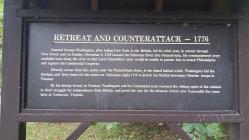
General George Washington, after losing New York to the British, led his rebel army in retreat through New Jersey and on Sunday, December 8, 1776 crossed the Delaware River into Pennsylvania. He commandeered every available boat along the river so that Lord Cornwallis's army would be unable to pursue him to attack Philadelphia and capture the Continental Congress.
Directly across from this point, near the Pennsylvania shore, is the island behind which Washington hid the Durham and ferry boats for his return on Christmas night 1776 to attack the British mercenary Hessian troops in Trenton.
By his daring victory at Trenton, Washington and his Continental army restored the ebbing spirit of the colonies in their struggle for independence from Britain, and paved the way for the ultimate victory over Cornwallis five years later at Yorktown, Virginia.
Details
| HM Number | HM4I3 |
|---|---|
| Tags | |
| Placed By | Washington Crossing State Park |
| Marker Condition |           8 out of 10 (1 reports) |
| Date Added | Tuesday, October 21st, 2014 at 2:27am PDT -07:00 |
Pictures
Photo Credits: [1] DAWN ENGLER
Locationbig map
| UTM (WGS84 Datum) | 18T E 511136 N 4460865 |
|---|---|
| Decimal Degrees | 40.29821667, -74.86896667 |
| Degrees and Decimal Minutes | N 40° 17.893', W 74° 52.138' |
| Degrees, Minutes and Seconds | 40° 17' 53.58" N, 74° 52' 8.28" W |
| Driving Directions | Google Maps |
| Area Code(s) | 908, 609 |
| Closest Postal Address | At or near 141 River Dr, Hopewell Township NJ 08560, US |
| Alternative Maps | Google Maps, MapQuest, Bing Maps, Yahoo Maps, MSR Maps, OpenCycleMap, MyTopo Maps, OpenStreetMap |
Is this marker missing? Are the coordinates wrong? Do you have additional information that you would like to share with us? If so, check in.
Nearby Markersshow on map
Show me all markers in: Hopewell Township, NJ | Mercer County | 08560 | New Jersey | United States of America
Maintenance Issues
- Is this marker part of a series?
- What historical period does the marker represent?
- What historical place does the marker represent?
- What type of marker is it?
- What class is the marker?
- What style is the marker?
- Does the marker have a number?
- What year was the marker erected?
- This marker could use another picture or two.
- Can this marker be seen from the road?
- Is the marker in the median?

Comments 0 comments