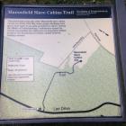
Inscription
The Battle of Fredericksburg
On this knoll stood Bernard's Cabins, a small community that in 1860 was home to about three dozen slaves. The complex consisted of three two-room cabins, a stone-lined well, and perhaps two additional buildings. This was only one of several such clusters of slave housing scattered across the 1,800-acre "Mannsfield" estate.The men and women who lived here helped power the most prosperous plantation in the Fredericksburg area. Arthur Bernard's plantation house, "Mannsfield" (1766), stood about a mile east of here (it burned in 1863). During the 1862 Battle of Fredericksburg it served as headquarters for three top Union generals - W.B. Franklin, J.F. Reynolds, and W.F. Smith.
Details
| HM Number | HM4ZD |
|---|---|
| Tags | |
| Placed By | Fredericksburg and Spotsylvania National Military Park - National Park Service |
| Marker Condition | No reports yet |
| Date Added | Friday, October 17th, 2014 at 6:14am PDT -07:00 |
Pictures
Photo Credits: [1] JOHN G BERNARD [2] JOHN G BERNARD [3] JOHN G BERNARD [4] JOHN G BERNARD
Locationbig map
| UTM (WGS84 Datum) | 18S E 285261 N 4237490 |
|---|---|
| Decimal Degrees | 38.25980000, -77.45435000 |
| Degrees and Decimal Minutes | N 38° 15.588', W 77° 27.261' |
| Degrees, Minutes and Seconds | 38° 15' 35.28" N, 77° 27' 15.66" W |
| Driving Directions | Google Maps |
| Area Code(s) | 540 |
| Closest Postal Address | At or near 490 Lansdowne Rd, Fredericksburg VA 22401, US |
| Alternative Maps | Google Maps, MapQuest, Bing Maps, Yahoo Maps, MSR Maps, OpenCycleMap, MyTopo Maps, OpenStreetMap |
Is this marker missing? Are the coordinates wrong? Do you have additional information that you would like to share with us? If so, check in.
Nearby Markersshow on map
Maintenance Issues
- Is this marker part of a series?
- What historical period does the marker represent?
- What historical place does the marker represent?
- What type of marker is it?
- What class is the marker?
- What style is the marker?
- Does the marker have a number?
- What year was the marker erected?
- Can this marker be seen from the road?
- Is the marker in the median?


Comments 0 comments