Inscription
[Left plaque]:
Last of a series of forts which, from the Dutch ssettlement of 1624, guarded lower Manhattan, this structure was built by the United States in the years 1808 to 1811. It was first called "West Battery," and was one of the important defenses of New York Harbor during the War of 1812 period. Named in honor of Gov. DeWitt Clinton in 1815, in that year it was made headquarters, U.S. Third Military District. From 1816 to 1820 Gen. Winfield Scott was in command. The Headquarters was removed from Castle Clinton to Governors Island in 1820.
[Right plaque]:
Ceded to New York City in 1823, Castle Clinton was renamed Castled Garden in 1824. Until 1855 it served as a public center and theater where public figures, including lafayette, Kossuth, and President Jackson, were received, and artists such as Jenny Lind were presented. From 1855 to 1890, the structure was the nation's principal immigrant depot, with over 7 million immigrants entering its portals - the "Gateway to the New World." Between 1896 and 1941 the old structure served as the New York City Acquarium. It was created a national monument in 1950.
Details
| HM Number | HM5JU |
|---|---|
| Tags | |
| Placed By | National Park Service |
| Marker Condition | No reports yet |
| Date Added | Friday, October 17th, 2014 at 2:22pm PDT -07:00 |
Pictures
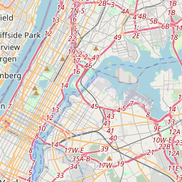
Locationbig map

| UTM (WGS84 Datum) | 18T E 583089 N 4506316 |
|---|---|
| Decimal Degrees | 40.70356667, -74.01643333 |
| Degrees and Decimal Minutes | N 40° 42.214', W 74° 0.986' |
| Degrees, Minutes and Seconds | 40° 42' 12.84" N, 74° 0' 59.16" W |
| Driving Directions | Google Maps |
| Area Code(s) | 212, 917, 646, 516, 347, |
| Closest Postal Address | At or near 1818 Battery Park Underpass, New York NY 10004, US |
| Alternative Maps | Google Maps, MapQuest, Bing Maps, Yahoo Maps, MSR Maps, OpenCycleMap, MyTopo Maps, OpenStreetMap |
Is this marker missing? Are the coordinates wrong? Do you have additional information that you would like to share with us? If so, check in.
Nearby Markersshow on map
Show me all markers in: New York, NY | New York County | 10004 | New York | United States of America
Maintenance Issues
- Is this marker part of a series?
- What historical period does the marker represent?
- What historical place does the marker represent?
- What type of marker is it?
- What class is the marker?
- What style is the marker?
- Does the marker have a number?
- What year was the marker erected?
- This marker needs at least one picture.
- Can this marker be seen from the road?
- Is the marker in the median?
Comments 0 comments