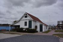
Inscription
Known as the "Great White Hurricane," the Blizzard of 1888 was one of the most devastating weather events in recorded history. Affecting coastal states from Virginia to Maine, this paralyzing storm resulted in widespread death and destruction. With its large stone Breakwater providing a buffer from heavy seas, the harbor at Lewes was considered to be one of the safest on the Atlantic seaboard at the time. For the ships that sought shelter here during the blizzard, it would be the scene of an unprecedented disaster. As signs of an approaching storm increased, approximately 50 vessels had come to anchor behind the seawall by the evening of March 11, 1888. A brief calm descended just before midnight, followed quickly by rapidly growing winds and decreasing temperatures. Soon a raging storm descended upon the harbor, bearing with it "flying hail and snow that cut like a lash...and salt spray that froze into a glassy coating the instant the water touched decks, spars, or rigging." By the morning of March 12, nearly every vessel in the harbor was sunken, sinking, or drifting powerless, crashing one upon another. Some sailors clung to the masts of ice-bound ships, where they endured the continuing effects of the storm. The crews of the Lewes and Cape Henlopen Life-Saving stations, aided by the citizens of Lewes, immediately launched efforts to save those in peril. As a result of their heroic deeds, many lucky souls were saved during the days that followed. The fact that only eight deaths were reported here was considered nothing less than miraculous for those who experienced the terrible fury of the Blizzard of 1888.
Details
| HM Number | HMCPA |
|---|---|
| Tags | |
| Marker Number | SC221 |
| Year Placed | 2008 |
| Placed By | Delaware Public Archives |
| Marker Condition | No reports yet |
| Date Added | Wednesday, September 17th, 2014 at 12:39pm PDT -07:00 |
Pictures
Photo Credits: [1] BRIDGER1963 [2] BRIDGER1963
Locationbig map
| UTM (WGS84 Datum) | 18S E 487726 N 4292162 |
|---|---|
| Decimal Degrees | 38.77810000, -75.14130000 |
| Degrees and Decimal Minutes | N 38° 46.686', W 75° 8.478' |
| Degrees, Minutes and Seconds | 38° 46' 41.16" N, 75° 8' 28.68" W |
| Driving Directions | Google Maps |
| Area Code(s) | 302 |
| Closest Postal Address | At or near 2 Shipcarpenter St, Lewes DE 19958, US |
| Alternative Maps | Google Maps, MapQuest, Bing Maps, Yahoo Maps, MSR Maps, OpenCycleMap, MyTopo Maps, OpenStreetMap |
Is this marker missing? Are the coordinates wrong? Do you have additional information that you would like to share with us? If so, check in.
Nearby Markersshow on map
Maintenance Issues
- Is this marker part of a series?
- What historical period does the marker represent?
- What historical place does the marker represent?
- What type of marker is it?
- What class is the marker?
- What style is the marker?
- This marker could use another picture or two.
- Can this marker be seen from the road?
- Is the marker in the median?


Comments 0 comments