Inscription
Thirteen men and boys, suspected of Unionism, were killed by Confederate soldiers in early 1863. Graves 8 mi. E.
Details
| HM Number | HMFAR |
|---|---|
| Tags | |
| Marker Number | P 71 |
| Year Placed | 1988 |
| Placed By | Division Of Archives and History |
| Marker Condition | No reports yet |
| Date Added | Friday, October 3rd, 2014 at 12:19pm PDT -07:00 |
Pictures
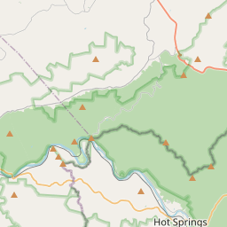
Locationbig map
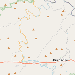

| UTM (WGS84 Datum) | 17S E 342765 N 3978142 |
|---|---|
| Decimal Degrees | 35.93500000, -82.74306667 |
| Degrees and Decimal Minutes | N 35° 56.1', W 82° 44.584' |
| Degrees, Minutes and Seconds | 35° 56' 6.00" N, 82° 44' 35.04" W |
| Driving Directions | Google Maps |
| Area Code(s) | 828 |
| Closest Postal Address | At or near 75 Guntertown Rd, Marshall NC 28753, US |
| Alternative Maps | Google Maps, MapQuest, Bing Maps, Yahoo Maps, MSR Maps, OpenCycleMap, MyTopo Maps, OpenStreetMap |
Is this marker missing? Are the coordinates wrong? Do you have additional information that you would like to share with us? If so, check in.
Nearby Markersshow on map
Maintenance Issues
- Is this marker part of a series?
- What historical period does the marker represent?
- What historical place does the marker represent?
- What type of marker is it?
- What class is the marker?
- What style is the marker?
- This marker needs at least one picture.
- Can this marker be seen from the road?
- Is the marker in the median?
Comments 0 comments