Inscription
Civil War to Civil Rights
— Downtown Heritage Trail —
"Main Street" for the city and the nation.Just a few steps ahead is Pennsylvania Avenue the inaugural parade route for every president since Thomas Jefferson and "Main Street" for local Washington since the city's founding. Jefferson planted the first trees along the avenue, and in the early days of the city it was a promenade lined with shops, hotels and boarding houses. Mary Todd Lincoln shopped here. The street was also the scene of President Lincoln's funeral procession.
By the start of the Civil War, the area across Pennsylvania Avenue had become a run-down neighborhood of theaters, saloons, cheap hotels, light industry, and houses of ill repute. Its activities earned it the name "Murder Bay" and sometimes "Hooker's Department" after Civil War General Joseph Hooker, whose plan it was to concentrate the activities of prostitutes in this area. It remained a light industrial area until the 1930s when a growing federal government consolidated offices that had been scattered in rented buildings around the city and built the complex of Neo-classical buildings known collectively as the Federal Triangle.
In the 1970s, the Pennsylvania Avenue Development Corporation began revitalization of this side of the Avenue, bringing new office, commercial and residential buildings to the street while preserving some of its 19th-century landmarks.
[Photo captions:]
Left and above
Mary Todd Lincoln shopped on an unpaved Pennsylvania Avenue that looked like this during the Civil War. Her bill for goods for the White House appears above. (Library of Congress; Washingtoniana Division, DC Public Library.)
Right and below
The Avenue has been the scene of countless parades, including Lincoln's funeral procession, right, in 1865 and a women's suffrage march in 1913. (Library of Congress; Washingtoniana Division, DC Public Library.)
(Back):
The Civil War (1861 - 1865) transformed Washington, DC from a muddy backwater to a center of national power. Ever since, the city has been at the heart of the continuing struggle to realize fully the ideas for which the war was fought. The 25 signs that mark this trail follow the footsteps of Abraham Lincoln, Walt Whitman, Clara Barton, Frederick Douglas, and others, famous and humble, who shaped a nation and its capital city while living and working in historic downtown DC.
Civil War to Civil Rights Downtown Heritage Trail is an Official Washington, DC Walking Trail. The self-guided tour consists of three distinct loops: West, Center, and East. Each one-mile loop offers about an hour of gentle exercise.
A free booklet capturing the trail's highlights is available at local businesses and institutions along the way. To download the free Civil War to Civil Rights Audio Tour, and learn about other DC neighborhoods, please visit www.CuturalTourismDC.org.
Details
| HM Number | HMJRM |
|---|---|
| Series | This marker is part of the Civil War to Civil Rights series |
| Tags | |
| Marker Number | .8 |
| Placed By | Cultural Tourism DC |
| Marker Condition | No reports yet |
| Date Added | Saturday, October 25th, 2014 at 6:58am PDT -07:00 |
Pictures
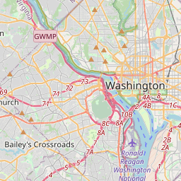
Locationbig map

| UTM (WGS84 Datum) | 18S E 324286 N 4307068 |
|---|---|
| Decimal Degrees | 38.89493333, -77.02613333 |
| Degrees and Decimal Minutes | N 38° 53.696', W 77° 1.568' |
| Degrees, Minutes and Seconds | 38° 53' 41.76" N, 77° 1' 34.08" W |
| Driving Directions | Google Maps |
| Area Code(s) | 202 |
| Closest Postal Address | At or near 406 10th St NW, Washington DC 20004, US |
| Alternative Maps | Google Maps, MapQuest, Bing Maps, Yahoo Maps, MSR Maps, OpenCycleMap, MyTopo Maps, OpenStreetMap |
Is this marker missing? Are the coordinates wrong? Do you have additional information that you would like to share with us? If so, check in.
Nearby Markersshow on map
Maintenance Issues
- What historical period does the marker represent?
- What historical place does the marker represent?
- What type of marker is it?
- What class is the marker?
- What style is the marker?
- What year was the marker erected?
- This marker needs at least one picture.
- Can this marker be seen from the road?
- Is the marker in the median?
Comments 0 comments