Inscription
The Baltimore Maritime Museum
Lightship 116 "Chesapeake" was built in 1930 as a manned navigational beacon and fulfilled this role under the US Lightship Service and the US Coast Guard for nearly 40 years. On station in all weather and sea conditions, lightships and their crews guided vital maritime traffic to and from American shores for generations. There are no longer any lightships on duty; they have all been replaced by automatic beacons.The US Lighthouse Service first assigned Lightship 116 to the Fenwick Island Shoal (DE) Station from 1930-33; after that assignment she marked the entrance to Chesapeake Bay until the beginning of World War II. During 1942-45 Lightship 116 was employed as an armed inspection vessel near the entrance to the Cape Cod Canal (MA). In 1945 the ship returned to the waters off Cape Henry (VA) where her bright red hull, beacon light and "Chesapeake" station designation guided maritime traffic in and out of the Chesapeake Bay for the next 20 years. In 1965, the Chesapeake Lightship Station was replaced by a Coast Guard offshore light tower and Lightship 116's final duty was to mark the approaches to Delaware Bay. In 1970 she was transferred to the National Park Service and used as a sea-going environmental classroom. Then in 1982 she was turned over to the city of Baltimore and she became part of the Baltimore Maritime Museum in 1988.
Details
| HM Number | HMLUR |
|---|---|
| Tags | |
| Placed By | Baltimore City Heritage Area |
| Marker Condition | No reports yet |
| Date Added | Thursday, September 4th, 2014 at 6:27pm PDT -07:00 |
Pictures
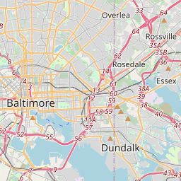
Locationbig map

| UTM (WGS84 Datum) | 18S E 361252 N 4349746 |
|---|---|
| Decimal Degrees | 39.28598333, -76.60876667 |
| Degrees and Decimal Minutes | N 39° 17.159', W 76° 36.526' |
| Degrees, Minutes and Seconds | 39° 17' 9.54" N, 76° 36' 31.56" W |
| Driving Directions | Google Maps |
| Area Code(s) | 301, 410, 443 |
| Closest Postal Address | At or near 345-399 Harbor Bridge Walk, Baltimore MD 21202, US |
| Alternative Maps | Google Maps, MapQuest, Bing Maps, Yahoo Maps, MSR Maps, OpenCycleMap, MyTopo Maps, OpenStreetMap |
Is this marker missing? Are the coordinates wrong? Do you have additional information that you would like to share with us? If so, check in.
Nearby Markersshow on map
The Great Baltimore Oyster Partnership
Baltimore Riot Trail
Together we remember the people of Maryland who perished on 9.11.2001
An Active Port for 300 Years
Top of the World Observation Level World Trade Center
Dr. William V. Lockwood
Discover Baltimore: Four Centuries of Change
USS Constellation
The Port of Baltimore
Exodus 1947: "The ship That Launched a Nation"
Maintenance Issues
- Is this marker part of a series?
- What historical period does the marker represent?
- What historical place does the marker represent?
- What type of marker is it?
- What class is the marker?
- What style is the marker?
- Does the marker have a number?
- What year was the marker erected?
- This marker needs at least one picture.
- Can this marker be seen from the road?
- Is the marker in the median?
Comments 0 comments