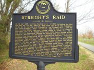
Inscription
On 26 Apr 1863, a Union raiding party of 1500 including the 51st and 73rd IN, 3rd OH, 18th IL. and local men from two companies of the 1st AL. Calvary left Tuscumbia for Russellville. Led by Col. Abel Streight, their objective was to cut Confederate Gen. Braxton Bragg's railroad supply lines at Rome, GA. As a diversion, Gen. G.M. Dodge with some 8000 Union troops moved into northern Lawrence County to occupy the attention of Gen. Nathan B. Forrest. While Dodge distracted Forrest, Streight marched from Russellville to Mt. Hope on 27 Apr. As Dodge retreated toward Corinth, MS, Forrest was informed to Streight's movements. The next day, Streight confiscated some 200 mules and horse before arriving in Moulton after sunset. Leaving Moulton 1:00 a.m. on 29 Apr, the raiders rode along this old road. At the same time, Forrest began to pursue Streight. The next morning at Day's Gap, Forrest engaged and fought the mountaintop where Streight laid an ambush. Losing some 40 men in this ambush, Moulton native Col. Phillip Roddy of the 4th AL was ordered to Decatur. After a series of skirmishes, facing dwindling supplies, and believing his forces outnumbered, Streight surrendered to Forrest's 500 men on 3 May 1863, in Cherokee County, AL a few miles from Rome, GA.
Details
| HM Number | HMO2Z |
|---|---|
| Tags | |
| Placed By | Lawrence County Historical Commission Inc |
| Marker Condition |           9 out of 10 (1 reports) |
| Date Added | Saturday, September 27th, 2014 at 6:53pm PDT -07:00 |
Pictures
Locationbig map
| UTM (WGS84 Datum) | 16S E 483564 N 3811104 |
|---|---|
| Decimal Degrees | 34.44131667, -87.17890000 |
| Degrees and Decimal Minutes | N 34° 26.479', W 87° 10.734' |
| Degrees, Minutes and Seconds | 34° 26' 28.74" N, 87° 10' 44.04" W |
| Driving Directions | Google Maps |
| Area Code(s) | 256 |
| Closest Postal Address | At or near 1201-1317 Co Rd 187, Danville AL 35619, US |
| Alternative Maps | Google Maps, MapQuest, Bing Maps, Yahoo Maps, MSR Maps, OpenCycleMap, MyTopo Maps, OpenStreetMap |
Is this marker missing? Are the coordinates wrong? Do you have additional information that you would like to share with us? If so, check in.
Nearby Markersshow on map
Maintenance Issues
- Is this marker part of a series?
- What historical period does the marker represent?
- What historical place does the marker represent?
- What type of marker is it?
- What class is the marker?
- What style is the marker?
- Does the marker have a number?
- What year was the marker erected?
- This marker could use another picture or two.
- Can this marker be seen from the road?
- Is the marker in the median?

Comments 0 comments