Inscription
The Role Of Taverns
In early America, taverns or "ordinaries" offered food and shelter. both for travelers and their horses. The term "ordinary" originally applied to a tavern meal regulary offered at a fixed price, but later designated the tavern itself. The Maryland Assembly, like other legislatures, not only required a license for operation and a bond for good conduct, but alsomandated a listing of the set prices for food, drink, and accommodations.[Picture included]
Because of poor roads, early taverns were generally 15 to 20 miles apart, a convenient day's travel. On the Great Road (now MD Route 355), a traveler from Georgetown to Frederick could stop at a tavern in Rockville before spending the next night at Dowden's Ordinary in Clarksburg. In his petition for a tavern license in 1750, Michael Dowden wrote that becausehis house was situated on the road between Rockville and Frederick Towne, he regularly recieved visitors requesting food and lodging for the night. Dowden decided to turn his hospitality into a business operation.
In addition to providing meals and lodging, taverns served as places for the locals to socialize, argue politics, conduct business, play cards, or bet on a horse race. At Dowden's, stagecoaches stopped twice a week bringing mail and news from communities along the route. More than a place to have a drink, taverns were the hub of community life. [Picture included]
Taverns's Ghost Structure
[Picture included]
The tavern "ghost structure" represents the original Dowden's Ordinary. The inn was a one-and-one-half story log structure with gabled dormers, a shingled roof, a covered porch, and two fireplaces. Later Dowden built an addition to his tavern giving it an L-shaped form. The actural site is located on the hill and is accessible by following the path past the cannon.
[Timeline included]
Details
| HM Number | HMTGA |
|---|---|
| Tags | |
| Placed By | Montgomery County Parks |
| Marker Condition | No reports yet |
| Date Added | Tuesday, October 7th, 2014 at 9:16pm PDT -07:00 |
Pictures
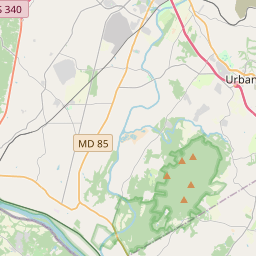
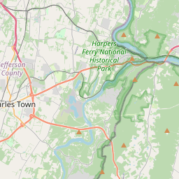
Locationbig map
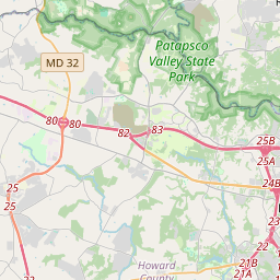

| UTM (WGS84 Datum) | 18S E 303408 N 4345531 |
|---|---|
| Decimal Degrees | 39.23683333, -77.27781667 |
| Degrees and Decimal Minutes | N 39° 14.21', W 77° 16.669' |
| Degrees, Minutes and Seconds | 39° 14' 12.60" N, 77° 16' 40.14" W |
| Driving Directions | Google Maps |
| Area Code(s) | 301, 240 |
| Closest Postal Address | At or near 23200 Stringtown Rd, Clarksburg MD 20871, US |
| Alternative Maps | Google Maps, MapQuest, Bing Maps, Yahoo Maps, MSR Maps, OpenCycleMap, MyTopo Maps, OpenStreetMap |
Is this marker missing? Are the coordinates wrong? Do you have additional information that you would like to share with us? If so, check in.
Nearby Markersshow on map
Show me all markers in: Clarksburg, MD | Montgomery County | 20871 | Maryland | United States of America
Archaeology at Dowden's Ordinary
Dowden's Ordinary: A French & Indian War Site
Dowden's Ordinary: The Elephant Comes to Clarksburg
Dowden's Ordinary
Welcome to Froggy Hollow
Waters' Mill Historical
A Real Field of Dreams Historical
Black Hill Gold Mine
To Honor the Memory of George A, (Jay) Chadwick Jr.
Women on the Homefront in Montgomery County
Maintenance Issues
- Is this marker part of a series?
- What historical period does the marker represent?
- What historical place does the marker represent?
- What type of marker is it?
- What class is the marker?
- What style is the marker?
- Does the marker have a number?
- What year was the marker erected?
- This marker needs at least one picture.
- Can this marker be seen from the road?
- Is the marker in the median?
Comments 0 comments