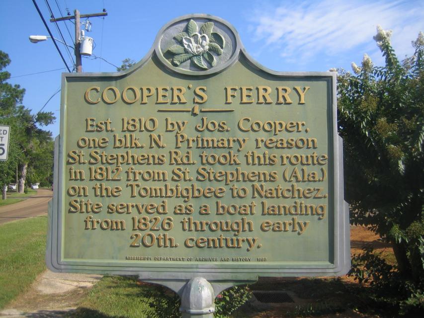
Inscription
Est. 1810 by Jos. Cooper, one blk. N. Primary reason St. Stephens Rd. took this route in 1812 from St. Stephens (Ala.) on the Tombigbee to Natchez. Site served as boat landing from 1826 through early 20th century.
Details
| HM Number | HMXUY |
|---|---|
| Tags | |
| Year Placed | 1985 |
| Placed By | Mississippi Department of Archives and History |
| Marker Condition | No reports yet |
| Date Added | Wednesday, October 15th, 2014 at 3:52pm PDT -07:00 |
Pictures
Locationbig map
| UTM (WGS84 Datum) | 15R E 774484 N 3494740 |
|---|---|
| Decimal Degrees | 31.55501667, -90.10846667 |
| Degrees and Decimal Minutes | N 31° 33.301', W 90° 6.508' |
| Degrees, Minutes and Seconds | 31° 33' 18.06" N, 90° 6' 30.48" W |
| Driving Directions | Google Maps |
| Area Code(s) | 601 |
| Closest Postal Address | At or near 131 Brookhaven St, Monticello MS 39654, US |
| Alternative Maps | Google Maps, MapQuest, Bing Maps, Yahoo Maps, MSR Maps, OpenCycleMap, MyTopo Maps, OpenStreetMap |
Is this marker missing? Are the coordinates wrong? Do you have additional information that you would like to share with us? If so, check in.
Nearby Markersshow on map
Show me all markers in: Monticello, MS | Lawrence County | 39654 | Mississippi | United States of America
Maintenance Issues
- Is this marker part of a series?
- What historical period does the marker represent?
- What historical place does the marker represent?
- What type of marker is it?
- What class is the marker?
- What style is the marker?
- Does the marker have a number?
- This marker could use another picture or two.
- Can this marker be seen from the road?
- Is the marker in the median?
Comments 0 comments