Inscription
June 26-29, 1804
Side A: Lewis and Clark at Kaw PointThe Lewis and Clark expedition arrived here at Kaw Point on June 26, 1804, concluding another daily struggle against the powerful current of the Missouri River. Captain William Clark wrote in his journal that "our tow rope broke twice & with great exertions...we Came to and Camped in the Point" above the confluence of the Missouri and Kansas (Kaw) Rivers.
The Corps of Discovery carried the destiny of our young nation on this scientific and diplomatic mission providing notice of the recent purchase of the Louisiana Territory by the United States.
This military expedition consisted of a keelboat and two pirogues (large canoes), approximately 46 men, including an army interpreter, the African-American York, at least ten temporary river men, plus four horses, and Lewis's Newfoundland dog, Seaman.
Captains William Clark and Meriwether Lewis directed the repair of the boats and the exploration of the confluence area. "To defend ourselves against the Indians" the captains ordered the men to erect across the point a "...strong redoubt or brest work frome one river to the other, of logs and brushes six feet high."
John Ordway and a hunting party traveled up the Kansas River valley and killed several deer, sighted their first buffalo, captured a wolf pup, and found excellent springs.
A Courts-martial was convened on June 29, which resulted in Pvt. John Collins, who was on sentry duty, received 100 lashes and Pvt. Hugh Hall 50 lashes for drawing whiskey without authority.
Side B: Kaw Point
The Missouri River can be seen to the east and the Kansas (Kaw) River can be seen to the south. The confluence of these rivers is the original reason for the geographic location of the Kansas City metropolitan area.
Captain William Clark wrote on June 27, 1804, that "the Countrey about the mouth of this river is verry fine." The expedition's journals say that the confluence area would be a fine place for a fort and that this area teemed with deer, elk, buffalo and bear, plus a great number of "Parrot queets", the now extinct Carolina parakeet.
Claimed alternately by Spain and France until 1803 when it became part of President Thomas Jefferson's purchase of Louisiana, this point of land soon became known as Kaw Point. The north-south line through this confluence became the western border of the state of Missouri in 1821 and settlers began to arrive on the Missouri side of this border.
In 1830 Congress passed the Indian Removal Act, which created Indian Territory and called for all eastern tribes to be removed to west of the Missouri border. Although the Kanza Indians were in this general area, the Delaware Indian reserve was created in 1829 which included Kaw Point. The Wyandot Indians arrive in 1843 and purchased land from the Delawares that included Kaw Point.
In 1854 Kaw Point became part of Kansas Territory with the passage by Congress of the Kansas-Nebraska Act, which opened the territory for white settlement. In 1859 the town of Wyandott, which included Kaw Point, was incorporated. Kaw Point became a part of Kansas City, Kansas as a result of the consolidation of 1886.
Details
| HM Number | HM10HD |
|---|---|
| Series | This marker is part of the Lewis & Clark Expedition series |
| Tags | |
| Year Placed | 2005 |
| Placed By | Native Sons of Kansas City |
| Marker Condition | No reports yet |
| Date Added | Monday, September 15th, 2014 at 7:39am PDT -07:00 |
Pictures
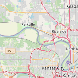
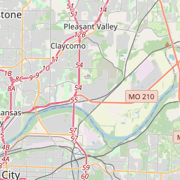
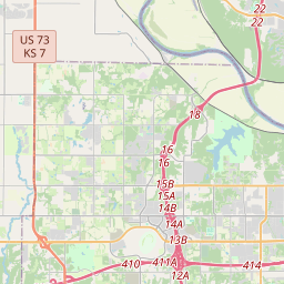
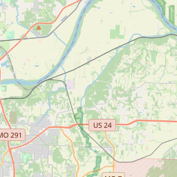
Locationbig map

| UTM (WGS84 Datum) | 15S E 360702 N 4330929 |
|---|---|
| Decimal Degrees | 39.11640000, -94.61126667 |
| Degrees and Decimal Minutes | N 39° 6.984', W 94° 36.676' |
| Degrees, Minutes and Seconds | 39° 6' 59.04" N, 94° 36' 40.56" W |
| Driving Directions | Google Maps |
| Area Code(s) | 913 |
| Closest Postal Address | At or near 4001-4149 Boardwalk, Kansas City KS 66115, US |
| Alternative Maps | Google Maps, MapQuest, Bing Maps, Yahoo Maps, MSR Maps, OpenCycleMap, MyTopo Maps, OpenStreetMap |
Is this marker missing? Are the coordinates wrong? Do you have additional information that you would like to share with us? If so, check in.
Nearby Markersshow on map
Show me all markers in: Kansas City, KS | Wyandotte County | 66115 | Kansas | United States of America
Bird Woman's Trail
"we determin to delay at this Place"
The Lewis and Clark Expedition
Encampment at Kaw's Mouth - June 26-29, 1804
Homeland of the Kanza Indians
"the water...contains a half...Glass of ooze"
The Cruise-Scroggs Mansion
Commissioner Thomas F. Lally
This Gateway to Kansas
First Baptist Church and First African Methodist Episcopal Church
Maintenance Issues
- What historical period does the marker represent?
- What historical place does the marker represent?
- What type of marker is it?
- What class is the marker?
- What style is the marker?
- Does the marker have a number?
- This marker needs at least one picture.
- Can this marker be seen from the road?
- Is the marker in the median?
Comments 0 comments