Inscription
On the morning of September 17, 1923, a grass fire spread from Wildcat Canyon over the hills into Berkeley. Driven by hot, dry winds, the fire spread rapidly across the northeast residential districts of the city, burning as far south and west as this downtown block.
In just a few hours, nearly 600 homes and dozens of entire blocks burned north of the University of California campus and east of Shattuck Avenue. Downwind, a rain of blowing embers started small fires and endangered buildings throughout the business district and in central, west and south Berkeley.
The Berkeley Fire Department and fire engine companies from other cities - including some rushed over from San Francisco on a ferry boat - fought to save the city. Finally in late afternoon when the wind died down, they were able to contain the fire. East of the developed parts of the city and the University campus, the fire continued to burn through the dry hills and canyons well into the night.
Professional firefighters were assisted by many volunteers, including hundreds of University of California students. Additional hundreds helped to evacuate people, save belongings, and guard the burned areas after the fire. Although no lives were lost, thousands of Berkeley residents were left homeless, including more than 1,000 - about 10% - of all University students and nearly one in for faculty families.
Across Oxford Street from this site, the northwest corner of the University of California campus was at the time a large field used for athletics and military drill practice. The field became a gathering place for refugees and salvaged belongings. Sites including Stephens Union (later Stephens Hall) on the campus, Berkeley's City Hall, Washington School, and the National Guard Armory on Addison Street were turned into relief centers and temporary shelters.
In Commemoration of the 75th Anniversary of the Fire
In just a few hours, nearly 600 homes and dozens of entire blocks burned north of the University of California campus and east of Shattuck Avenue. Downwind, a rain of blowing embers started small fires and endangered buildings throughout the business district and in central, west and south Berkeley.
The Berkeley Fire Department and fire engine companies from other cities - including some rushed over from San Francisco on a ferry boat - fought to save the city. Finally in late afternoon when the wind died down, they were able to contain the fire. East of the developed parts of the city and the University campus, the fire continued to burn through the dry hills and canyons well into the night.
Professional firefighters were assisted by many volunteers, including hundreds of University of California students. Additional hundreds helped to evacuate people, save belongings, and guard the burned areas after the fire. Although no lives were lost, thousands of Berkeley residents were left homeless, including more than 1,000 - about 10% - of all University students and nearly one in for faculty families.
Across Oxford Street from this site, the northwest corner of the University of California campus was at the time a large field used for athletics and military drill practice. The field became a gathering place for refugees and salvaged belongings. Sites including Stephens Union (later Stephens Hall) on the campus, Berkeley's City Hall, Washington School, and the National Guard Armory on Addison Street were turned into relief centers and temporary shelters.
Details
| HM Number | HM10OG |
|---|---|
| Tags | |
| Year Placed | 1998 |
| Placed By | Berkeley Historical Plaque Project |
| Marker Condition | No reports yet |
| Date Added | Wednesday, September 24th, 2014 at 2:06am PDT -07:00 |
Pictures
Locationbig map

| UTM (WGS84 Datum) | 10S E 564518 N 4192053 |
|---|---|
| Decimal Degrees | 37.87368333, -122.26640000 |
| Degrees and Decimal Minutes | N 37° 52.421', W 122° 15.984' |
| Degrees, Minutes and Seconds | 37° 52' 25.26" N, 122° 15' 59.04" W |
| Driving Directions | Google Maps |
| Area Code(s) | 510, 415 |
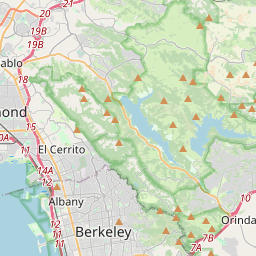
| Closest Postal Address | At or near 1916 Oxford St, Berkeley CA 94704, US |
| Alternative Maps | Google Maps, MapQuest, Bing Maps, Yahoo Maps, MSR Maps, OpenCycleMap, MyTopo Maps, OpenStreetMap |
Is this marker missing? Are the coordinates wrong? Do you have additional information that you would like to share with us? If so, check in.
Nearby Markersshow on map
Show me all markers in: Berkeley, CA | Alameda County | 94704 | California | United States of America
Maintenance Issues
- Is this marker part of a series?
- What historical period does the marker represent?
- What historical place does the marker represent?
- What type of marker is it?
- What class is the marker?
- What style is the marker?
- Does the marker have a number?
- This marker needs at least one picture.
- Can this marker be seen from the road?
- Is the marker in the median?
Comments 0 comments