Inscription
"Roads Almost Impassable"
— Carolinas Campaign —
Preface:The Carolinas Campaign began on February 1, 1865, when Union Gen. William T. Sherman led his army north from Savannah, Georgia, after the March to the Sea. Sherman's objective was to join Gen. Ulysses S. Grant in Virginia to crush Gen. Robert E. Lee's Army of Northern Virginia. Scattered Confederate forces consolidated in North Carolina, the Confederacy's logistical lifeline, where Sherman defeated Gen. Joseph E. Johnston's last-ditch attack at Bentonville. After Sherman was reinforced at Goldsboro late in March, Johnston saw the futility of further resistance and surrendered on April 26, essentially ending the Civil War.
Stewartsville was the the birthplace of Joseph Roswell Hawley, supporter of Abraham Lincoln, general in the U.S. Army, and U.S. Senator from Connecticut from 1881 to 1905. Hawley was born here on October 31, 1826, while his father served as a Methodist preacher nearby. The family returned to the north in 1837. After the Confederate port of Wilmington fell in 1865, Hawley was responsible for delivering supplies from there to Gen. William T. Sherman's troops. Afterward, and during the first year of Military Reconstruction, Hawley commanded in eastern North Carolina. According to local tradition, when he returned to his birthplace to introduce himself to the current residents, they refused to welcome anyone from the Federal army. Hawley nevertheless noted that "it gave me great pleasure to deal kindly with and sometimes grant favors to people from Richmond [present-day Scotland] county as they occasionally came under my notice."
Union Gen. Frank P. Blair, Jr., led his corps past here behind you on Barnes Bridge Road on March 8, 1865. Meanwhile, Confederate Gen. Joseph E. Johnston followed Gen. Robert E. Lee's orders to "concentrate all available forces and drive Sherman back," moving Gen. Joseph Wheeler's and William J. Hardee's commands ahead of the Federals.
Quote1:
Staff officers from the rear of General Smith's and Woods' trains report the roads almost impassable and the trains of both divisions terribly stretched out and miring badly. The rear of General Woods' train is reported as about one mile and a half this side of Springfield with about seventy wagons on the road." — Gen. John A. Logan, Laurel Hill, N.C., March 8, 1865
Quote2:
The road has become so bad that the other divisions will be obliged to camp within about three miles of here. The entire road has to be corduroyed [covered with logs over the mud]. ... There is water on each side of the [Lumber River] bridge and it will be necessary to bridge it in the morning should the river rise much to-night." — Gen. Frank P. Blair, Jr., Gilopolis, N.C., March 8, 1865
Details
| HM Number | HM124Q |
|---|---|
| Series | This marker is part of the North Carolina Civil War Trails series |
| Tags | |
| Placed By | North Carolina Civil War Trails |
| Marker Condition | No reports yet |
| Date Added | Sunday, October 5th, 2014 at 1:31am PDT -07:00 |
Pictures
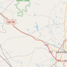
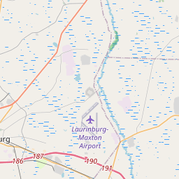
Locationbig map


| UTM (WGS84 Datum) | 17S E 644927 N 3845686 |
|---|---|
| Decimal Degrees | 34.74301667, -79.41678333 |
| Degrees and Decimal Minutes | N 34° 44.581', W 79° 25.007' |
| Degrees, Minutes and Seconds | 34° 44' 34.86" N, 79° 25' 0.42" W |
| Driving Directions | Google Maps |
| Area Code(s) | 910 |
| Closest Postal Address | At or near 18601 State Rd 1609, Laurinburg NC 28352, US |
| Alternative Maps | Google Maps, MapQuest, Bing Maps, Yahoo Maps, MSR Maps, OpenCycleMap, MyTopo Maps, OpenStreetMap |
Is this marker missing? Are the coordinates wrong? Do you have additional information that you would like to share with us? If so, check in.
Nearby Markersshow on map
Show me all markers in: Laurinburg, NC | Scotland County | 28352 | North Carolina | United States of America
Maintenance Issues
- What historical period does the marker represent?
- What historical place does the marker represent?
- What type of marker is it?
- What class is the marker?
- What style is the marker?
- Does the marker have a number?
- What year was the marker erected?
- This marker needs at least one picture.
- Can this marker be seen from the road?
- Is the marker in the median?
Comments 0 comments