Mount Vernon Cultural Walk
In the mansions surrounding the Mount Vernon squares, prominent Baltimoreans made major political, artistic and cultural contributions to the world. One such person was John Pendleton Kennedy (1795-1870), who lived on the site of the Peabody Institute in the 1830s and 1840s. He, along with James Fenimore Cooper and Washington Irving, helped to create and define American literature. He was also a U.S. Congressman, the Secretary of the Navy, a patron of Edgar Allan Poe, and a donor of land for the building of the Peabody Institute.
Another was John Work Garrett (1820-1884), president of the B&O Railroad between 1858 and 1884, who lived at 101 West Monument Street during the mid-19th century. During the Civil War, he ensured that the B&O Railroad replenished supplies and troops for the Union. After the Civil War, Garrett secured agreements with German steamship companies that ushered immigrants through the port of Baltimore and onto B&O trains heading west.
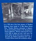
In the 20th century, Theodore Marburg (1862-1946) lived at 14 West Mount Vernon Place. As an architect of the International Peace Movement, he greatly contributed to the creation of the League of Nations, the forerunner of the United Nations. Other important residents include Senator William Cabell Bruce (1860-1946), shipping magnate Albert Schumacher (1802-1871), lottery king Colonel Richard E. France, and doctor and banker John Hanson Thomas (1813-1881).
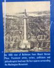
The four squares radiating from the monument became Baltimore's first planned open spaces. Created in 1831, the squares were simple, cleared lawns surrounded by a row of trees. In 1877, Frederick Law Olmsted, Sr., the father of landscape architecture and designer of Central Park in New York City, designed the north and south squares with Victorian sensibility. In 1902, the Olmsted Brothers Landscape Architects, the sons of Olmsted Sr., updated the design, and in 1916 architects Carrere and Hastings redesigned the squares into the current Beaux-Arts Classicism plan.
| HM Number | HM16F1 |
|---|---|
| Tags | |
| Historical Period | 19th Century |
| Historical Place | Other |
| Marker Type | Historic District |
| Marker Class | Historical Marker |
| Marker Style | Free Standing |
| Marker Condition | No reports yet |
| Date Added | Wednesday, October 1st, 2014 at 3:19pm PDT -07:00 |
| UTM (WGS84 Datum) | 18S E 360712 N 4351035 |
|---|---|
| Decimal Degrees | 39.29750000, -76.61530000 |
| Degrees and Decimal Minutes | N 39° 17.85', W 76° 36.918' |
| Degrees, Minutes and Seconds | 39° 17' 51.0000" N, 76° 36' 55.0800" W |
| Driving Directions | Google Maps |
| Area Code(s) | 301, 410, 443 |
| Can be seen from road? | Yes |
| Is marker in the median? | No |
| Which side of the road? | Marker is on the right when traveling North |
| Closest Postal Address | At or near 1 E Mt Vernon Pl, Baltimore MD 21202, US |
| Alternative Maps | Google Maps, MapQuest, Bing Maps, Yahoo Maps, MSR Maps, OpenCycleMap, MyTopo Maps, OpenStreetMap |
Is this marker missing? Are the coordinates wrong? Do you have additional information that you would like to share with us? If so, check in.
- Is this marker part of a series?
- Who or what organization placed the marker?



Comments 0 comments