Inscription
Washington-Rochambeau Revolutionary Route National Historic Trail
— Road to Victory —
Upon arrival of French forces in Newport, Rhode Island in July 1780, Baron Ludwig von Closen, a captain in the Royal Deux-Ponts Regiment, was selected by General Rochambeau as one of his aides-de-camp. Closen accompanied Rochambeau on most of his visits with General Washington and was chosen as courier of many important communications, including messages to the French fleet commanders Admirals de Barras and De Grasse. Closen kept a detailed diary of his activities throughout his stay in America, including the Yorktown Campaign of 1781.At Baltimore on 12 September 1781, Closen and his fellow aide-de-camp Baron Marie-Francois Cromot Dubourg decided to separate from the main army and seek a shorter route to Williamsburg. That evening they set out with four servants and 10 horses. Traveling without a guide they lost their way and spent the night at a remote farm. The next day they rode through Queen Anne to Upper Marlboro from where they continued to Port Tobaccco on 14 September.
Closen described Port Tobacco as "situated at the foot of a hill, where there is a stream bordered by about twenty houses....In the evening we had time to climb up to the church, which is situated on a dominating height, from which we had a delightful view." The church was St. Ignatius, described by Cromot Dubourg as "very handsome."
The next day they traveled to Laidler's Lower Ferry Landing at Charlestown (now Morgantown) where they took Hooes' Ferry to Point Mathias on the Virginia side of the Potomac. They reached Williamsburg on 18 September, Closen regularly entered the trenches with the regiment and had the satisfaction of witnessing Lord Cornwallis surrender his forces on 19 October 1781.
Details
| HM Number | HM16MS |
|---|---|
| Series | This marker is part of the The Washington-Rochambeau Route series |
| Tags | |
| Marker Condition | No reports yet |
| Date Added | Sunday, September 28th, 2014 at 1:29am PDT -07:00 |
Pictures
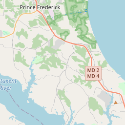
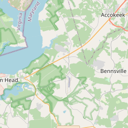
Locationbig map
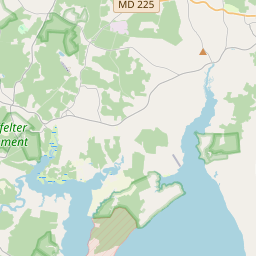

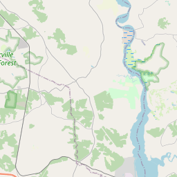


| UTM (WGS84 Datum) | 18S E 323886 N 4264477 |
|---|---|
| Decimal Degrees | 38.51126667, -77.01991667 |
| Degrees and Decimal Minutes | N 38° 30.676', W 77° 1.195' |
| Degrees, Minutes and Seconds | 38° 30' 40.56" N, 77° 1' 11.70" W |
| Driving Directions | Google Maps |
| Area Code(s) | 240, 301 |
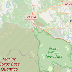
| Closest Postal Address | At or near 1301-1399 Warehouse Landing Rd, Port Tobacco MD 20677, US |
| Alternative Maps | Google Maps, MapQuest, Bing Maps, Yahoo Maps, MSR Maps, OpenCycleMap, MyTopo Maps, OpenStreetMap |
Is this marker missing? Are the coordinates wrong? Do you have additional information that you would like to share with us? If so, check in.
Nearby Markersshow on map
Show me all markers in: Port Tobacco, MD | Charles County | 20677 | Maryland | United States of America
Maintenance Issues
- What historical period does the marker represent?
- What historical place does the marker represent?
- What type of marker is it?
- What class is the marker?
- What style is the marker?
- Does the marker have a number?
- What year was the marker erected?
- Who or what organization placed the marker?
- This marker needs at least one picture.
- Can this marker be seen from the road?
- Is the marker in the median?
Comments 0 comments