Inscription
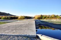
Located along the south bank of the San Antonio River it was at the junction of Pleyto Road and the road to Bradley. The town of Pleyto now lies under the waters of Lake San Antonio.
As early as 1796, the area was known as Pleito or El Pleito. Pleito, a Spanish legal term meaning ?litigation' or ?dispute', may have been applied due to a dispute between the San Miguel and San Antonio Missions over property rights. Another theory is that the Indian Rancheria of Assil, located near the old Pleyto Bridge, was a meeting place where Indians disagreements or lawsuits were settled.
On July 18, 1845, the land was granted to Jose Antonio Chavez as Rancho San Bartolome. Twelve years later the Rancho, by then known as Pleyto, was purchased by W.S. Johnson. In 1868 William Pinkerton, Sr. bought 13,100 acres of the ranch. It was Pinkerton who laid out the town.
A post office was opened on December 14, 1870 under the name ?Pleito'. The coast stage line, which maintained stables here, listed the stop as ?Plato Ranch' per its 1871 time table. By 1884 the post office name was changed to ?Pleyto'. Despite the changeable name, the town boasted a store, hotel, blacksmith shop, dance hall and school. The post office closed for the last time on February 14, 1929, and the town receded into memory. By 1964, when the San Antonio Dam was completed, few vestiges of the pioneer settlement remained.
Details
| HM Number | HM17RJ |
|---|---|
| Series | This marker is part of the E Clampus Vitus series |
| Tags | |
| Year Placed | 1998 |
| Placed By | E Clampus Vitus, Monterey Viejo Chapter No. 1846 |
| Marker Condition | No reports yet |
| Date Added | Monday, October 13th, 2014 at 7:19pm PDT -07:00 |
Pictures
Photo Credits: [1] KRISTY WILLIAMS [2] KRISTY WILLIAMS
Locationbig map
| UTM (WGS84 Datum) | 10S E 681391 N 3971697 |
|---|---|
| Decimal Degrees | 35.87273333, -120.99075000 |
| Degrees and Decimal Minutes | N 35° 52.364', W 120° 59.445' |
| Degrees, Minutes and Seconds | 35° 52' 21.84" N, 120° 59' 26.70" W |
| Driving Directions | Google Maps |
| Area Code(s) | 805 |
| Closest Postal Address | At or near 840 New Pleyto Rd, Bradley CA 93426, US |
| Alternative Maps | Google Maps, MapQuest, Bing Maps, Yahoo Maps, MSR Maps, OpenCycleMap, MyTopo Maps, OpenStreetMap |
Is this marker missing? Are the coordinates wrong? Do you have additional information that you would like to share with us? If so, check in.
Maintenance Issues
- What historical period does the marker represent?
- What historical place does the marker represent?
- What type of marker is it?
- What class is the marker?
- What style is the marker?
- Does the marker have a number?
- Can this marker be seen from the road?
- Is the marker in the median?


Comments 0 comments