Inscription
Hazardous Navigation
After the fall of Fort Donelson in February 1862, Federal forces gained control of Nashville and transported most of their supplies to the city via the Cumberland River. Extending for five miles along the river here, the Harpeth Shoals made navigation hazardous. The rough waters gave Confederate guerrillas an opportunity to disrupt the Union supply line. In 1862 and 1863, Confederate Col. Thomas G. Woodward's partisans frequently attacked Union shipping at the Shoals. Federal commanders sent frequent patrols to the area, but their poorly equipped cavalry and the guerrillas' ability todisperse rapidly thwarted Union attempts to control the Shoals effectively.On January 13, 1863, Confederate Gen. Joseph Wheeler's cavalry established positions nearby and ambushed Union ships. Wheeler's men destroyed two Union hospital ships, USS Trio and Parthenia, and one gunboat before retiring. Federal authorities sent large patrols to intercept Wheeler's force, but they were unsuccessful. Union Gen. William S. Rosecrans complained a month later that the attacks represented "inhuman violations of the rules of civilized warfare by the rebel authorities" that revealed the "barbarism of these rebel leaders." Confederate Gen. Braxton Bragg asked authorities to promote Wheeler "as a just reward to distinguished merit."
Federal forces resumed construction of the unfinished Nashville and Northwestern Railroad in 1863. Completed in May 1864, the rail line transported Union supplies into Nashville, thereby negating the navigational hazards of Harpeth Shoals. Confederate guerrillas mounted no more attacks on the Cumberland River in this area following the completion of the railroad.
(captions)
Gen. Joseph Wheeler Courtesy Library of Congress
"Guerillas burning Steamers on the Cumberland River" John Fitch, Annals of the Army of the Cumberland (1863)
(map) Courtesy of U.S. Corps of Engineers Archives, Nashville
Details
| HM Number | HM1B17 |
|---|---|
| Series | This marker is part of the Tennessee: Tennessee Civil War Trails series |
| Tags | |
| Placed By | Tennessee Civil War Trails |
| Marker Condition | No reports yet |
| Date Added | Wednesday, October 22nd, 2014 at 4:42am PDT -07:00 |
Pictures
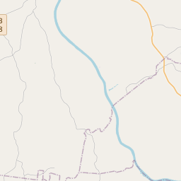
Locationbig map


| UTM (WGS84 Datum) | 16S E 486220 N 4017641 |
|---|---|
| Decimal Degrees | 36.30366667, -87.15348333 |
| Degrees and Decimal Minutes | N 36° 18.22', W 87° 9.209' |
| Degrees, Minutes and Seconds | 36° 18' 13.20" N, 87° 9' 12.54" W |
| Driving Directions | Google Maps |
| Area Code(s) | 615 |
| Closest Postal Address | At or near 1190 Dozier Boat Dock Rd, Charlotte TN 37036, US |
| Alternative Maps | Google Maps, MapQuest, Bing Maps, Yahoo Maps, MSR Maps, OpenCycleMap, MyTopo Maps, OpenStreetMap |
Is this marker missing? Are the coordinates wrong? Do you have additional information that you would like to share with us? If so, check in.
Nearby Markersshow on map
Maintenance Issues
- What historical period does the marker represent?
- What historical place does the marker represent?
- What type of marker is it?
- What class is the marker?
- What style is the marker?
- Does the marker have a number?
- What year was the marker erected?
- This marker needs at least one picture.
- Can this marker be seen from the road?
- Is the marker in the median?
Comments 0 comments