Inscription
In the late 19th century, this building was a center for political and economic life for the town of Weatherford and for Parker County. It was built around 1870. James Robertson Couts and John A. Fain established the first bank west of Dallas in this building, after Couts made a fortune selling cattle out west. Couts operated the bank with several partners, including Henry Warren, until 1877. Warren, a freighting contractor and thoroughbred stockbreeder, had previously been associated with the Warren Freight Train Massacre of 1871.
Couts and Warren dissolved their professional relationship in 1877 and sold the building to Samuel Willis Tucker Lanham, later governor of Texas (1903-1907). Lanham practiced law with other attorneys, such as A.J. Hood Sr., in second story offices. During the 1890s, the structure served as the offices for the troubled Franco-Texan Land Company, headed by Hood. The company was integral in the development of Texas land between Weatherford and El Paso along the Texas and Pacific Railway corridor. During this period the safe, from the Fidelity and Safe Deposit Company, was installed at the rear of the building. S.W.T. Lanham sold the property in 1906 to William Boone.
The Franco-Texan Land Company Building, previously known as the Couts Building and the Western Union Building, is an example of a typical vernacular storefront commercial building found in Texas during the last quarter of the 19th century. The two-story masonry fronted building features a brick exterior, stone string courses, french doors with fanlight transoms, and double-hung windows.Recorded Texas Historic Landmark 2012
Marker is property of the State of Texas
Couts and Warren dissolved their professional relationship in 1877 and sold the building to Samuel Willis Tucker Lanham, later governor of Texas (1903-1907). Lanham practiced law with other attorneys, such as A.J. Hood Sr., in second story offices. During the 1890s, the structure served as the offices for the troubled Franco-Texan Land Company, headed by Hood. The company was integral in the development of Texas land between Weatherford and El Paso along the Texas and Pacific Railway corridor. During this period the safe, from the Fidelity and Safe Deposit Company, was installed at the rear of the building. S.W.T. Lanham sold the property in 1906 to William Boone.
The Franco-Texan Land Company Building, previously known as the Couts Building and the Western Union Building, is an example of a typical vernacular storefront commercial building found in Texas during the last quarter of the 19th century. The two-story masonry fronted building features a brick exterior, stone string courses, french doors with fanlight transoms, and double-hung windows.
Marker is property of the State of Texas
Details
| HM Number | HM1CTW |
|---|---|
| Tags | |
| Marker Number | 17253 |
| Year Placed | 2012 |
| Placed By | Texas Historical Commission |
| Marker Condition | No reports yet |
| Date Added | Sunday, September 14th, 2014 at 4:02pm PDT -07:00 |
Pictures
Locationbig map

| UTM (WGS84 Datum) | 14S E 612575 N 3625120 |
|---|---|
| Decimal Degrees | 32.75820000, -97.79820000 |
| Degrees and Decimal Minutes | N 32° 45.492', W 97° 47.892' |
| Degrees, Minutes and Seconds | 32° 45' 29.52" N, 97° 47' 53.52" W |
| Driving Directions | Google Maps |
| Area Code(s) | 817, 682 |
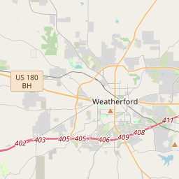
| Closest Postal Address | At or near 118 Houston St, Weatherford TX 76086, US |
| Alternative Maps | Google Maps, MapQuest, Bing Maps, Yahoo Maps, MSR Maps, OpenCycleMap, MyTopo Maps, OpenStreetMap |
Is this marker missing? Are the coordinates wrong? Do you have additional information that you would like to share with us? If so, check in.
Nearby Markersshow on map
Maintenance Issues
- Is this marker part of a series?
- What historical period does the marker represent?
- What historical place does the marker represent?
- What type of marker is it?
- What class is the marker?
- What style is the marker?
- This marker needs at least one picture.
- Can this marker be seen from the road?
- Is the marker in the median?
Comments 0 comments