Inscription
A common burial ground for early pioneer settlers who camped along the Clear Fork of the Trinity River, the Clark Cemetery consists of many burial sites from the 1830s. In December of 1853, Reverend John William Godfrey (1825-1897) and his wife, Anzaline (Barker) Godfrey (1831-1859), arrived in Parker County from Missouri. Godfrey established a Methodist Church in the Wright Community, northeast of Weatherford, where they lived. In 1859, Anzaline passed away and was buried in the Wright Community burial grounds. In 1880, Jim Clark and William Henry Ward formally established a permanent cemetery at the original location of Godfrey's Chapel Methodist Church. In 1953, signed documents deeded tract no. 1 and no. 2 of the land as burial plot property. Additional land was added in 1958 and in 1999.
In addition to numerous pioneer families and farmers, Clark Cemetery is the final resting place of a founder of early Parker County Methodist Churches, an organizer of Jack County, a trustee of an early pioneer school and a county chief justice. The oldest marked headstone in the cemetery belongs to Anzaline Godfrey, although sixty-five unidentified burial sites from the pioneer era were discovered with ground penetrating radar. The connection to military service is represented by veterans of the Texas Rangers, the Civil War, World War i, World War ii, Vietnam and the Korean War. The landscape of the Clark Cemetery is traditional with live oak, elm and post oak trees with a limestone and steel entrance gate, restrooms and a covered pavilion. The Clark Cemetery Association continues to care for this historic cemetery.Historic Texas Cemetery - 2011
Marker is property of the State of Texas
In addition to numerous pioneer families and farmers, Clark Cemetery is the final resting place of a founder of early Parker County Methodist Churches, an organizer of Jack County, a trustee of an early pioneer school and a county chief justice. The oldest marked headstone in the cemetery belongs to Anzaline Godfrey, although sixty-five unidentified burial sites from the pioneer era were discovered with ground penetrating radar. The connection to military service is represented by veterans of the Texas Rangers, the Civil War, World War i, World War ii, Vietnam and the Korean War. The landscape of the Clark Cemetery is traditional with live oak, elm and post oak trees with a limestone and steel entrance gate, restrooms and a covered pavilion. The Clark Cemetery Association continues to care for this historic cemetery.
Marker is property of the State of Texas
Details
| HM Number | HM1CUX |
|---|---|
| Tags | |
| Marker Number | 17320 |
| Year Placed | 2011 |
| Placed By | Texas Historical Commission |
| Marker Condition | No reports yet |
| Date Added | Monday, October 13th, 2014 at 7:06pm PDT -07:00 |
Pictures
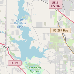
Locationbig map


| UTM (WGS84 Datum) | 14S E 620194 N 3634864 |
|---|---|
| Decimal Degrees | 32.84526667, -97.71561667 |
| Degrees and Decimal Minutes | N 32° 50.716', W 97° 42.937' |
| Degrees, Minutes and Seconds | 32° 50' 42.96" N, 97° 42' 56.22" W |
| Driving Directions | Google Maps |
| Area Code(s) | 817, 682 |
| Closest Postal Address | At or near 1386-1414 Friendship Rd, Weatherford TX 76085, US |
| Alternative Maps | Google Maps, MapQuest, Bing Maps, Yahoo Maps, MSR Maps, OpenCycleMap, MyTopo Maps, OpenStreetMap |
Is this marker missing? Are the coordinates wrong? Do you have additional information that you would like to share with us? If so, check in.
Nearby Markersshow on map
The Dean of Texas Trail Drivers Oliver Loving (1812 - 1867)
Old City Greenwood Cemetery
Parker County, C.S.A.
Franco-Texan Land Company Building
James Claude Wright House
August 17, 1945 B-29 Crash
Grace First Presbyterian Church
Bankhead Highway in Aledo
Poolville United Methodist Church
Consolidated Vultee Aircraft Corporation Plant No. 4
Maintenance Issues
- Is this marker part of a series?
- What historical period does the marker represent?
- What historical place does the marker represent?
- What type of marker is it?
- What class is the marker?
- What style is the marker?
- This marker needs at least one picture.
- Can this marker be seen from the road?
- Is the marker in the median?

Comments 0 comments