Inscription
Devils Tower National Monument
The process began about 50 million years ago. Magma (molten rock) was injected into layers of sedimentary rock, forming the Tower one and one-half miles below the earth's surface. It has since taken millions of years to erode away the surrounding sedimentary rock to expose the Tower we see today.Geologists agree the Tower is an igneous (hardened magma) intrusion, but have three different interpretations of the Tower's original size and shape. Because of erosion, we may never know which interpretation is correct.
Three Possible Interpretations
Igneous Stock:
The Tower is an irregularly shaped, igneous intrusion called a stock. It was formed when magma cooled and crystallized before reaching the earth's surface.
Laccolith:
The Tower is the remnant of a mushroom-shaped, igneous intrusion. As with the igneous stock, the magma solidified before reaching the earth's surface.
Volcanic Plug:
The Tower is a cylinder-shaped igneous intrusion, part of the plumbing system that fed a volcano. The pipe feeding the volcano became plugged when the magma solidified underground.
Details
| HM Number | HM1DLZ |
|---|---|
| Tags | |
| Placed By | National Park Service |
| Marker Condition | No reports yet |
| Date Added | Saturday, September 6th, 2014 at 5:33am PDT -07:00 |
Pictures
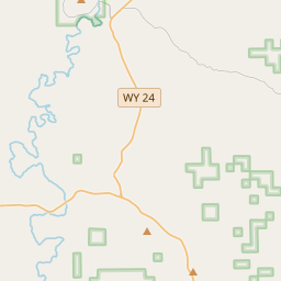
Locationbig map


| UTM (WGS84 Datum) | 13T E 522395 N 4937431 |
|---|---|
| Decimal Degrees | 44.58988333, -104.71785000 |
| Degrees and Decimal Minutes | N 44° 35.393', W 104° 43.071' |
| Degrees, Minutes and Seconds | 44° 35' 23.58" N, 104° 43' 4.26" W |
| Driving Directions | Google Maps |
| Area Code(s) | 307 |
| Closest Postal Address | At or near 360-398 Co Rd 174, Devils Tower WY 82714, US |
| Alternative Maps | Google Maps, MapQuest, Bing Maps, Yahoo Maps, MSR Maps, OpenCycleMap, MyTopo Maps, OpenStreetMap |
Is this marker missing? Are the coordinates wrong? Do you have additional information that you would like to share with us? If so, check in.
Nearby Markersshow on map
Show me all markers in: Devils Tower, WY | Crook County | 82714 | Wyoming | United States of America
Maintenance Issues
- Is this marker part of a series?
- What historical period does the marker represent?
- What historical place does the marker represent?
- What type of marker is it?
- What class is the marker?
- What style is the marker?
- Does the marker have a number?
- What year was the marker erected?
- This marker needs at least one picture.
- Can this marker be seen from the road?
- Is the marker in the median?
Comments 0 comments