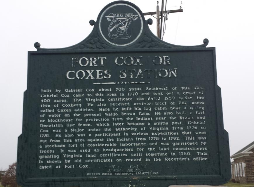
Inscription
Built by Gabriel Cox about 700 yards Southeast of this site. Gabriel Cox came to this area in 1770 and took out a grant of 400 acres. The Virginia certificate was dated 1780 under the title of Coxburg. He also received another tract of the 262 acres called Coxes addition. Here he built a log cabin near a spring of water on the present Waldo Brown farm. He also built a fort or blockhouse for protection from the Indians near the Brown and Denninston line fence, which later became a militia post. Gabriel Cox was a major under the authority of Virginia from 1776 to 1781. He also was a participant in various expeditions that went out from this area against the Indians from 1778 to 1782. This was a stockade fort of considerable importance and was garrisoned by tropps. It was used as headquarters for the land commissioners granting Virginia land certificates until sometime in 1780. This is shown by old certificates on record in the Recorder's office dated at Fort Cox.
Details
| HM Number | HM1HQH |
|---|---|
| Tags | |
| Placed By | Peters Creek Historical Society, Inc |
| Marker Condition | No reports yet |
| Date Added | Sunday, November 9th, 2014 at 3:01pm PST -08:00 |
Pictures
Locationbig map
| UTM (WGS84 Datum) | 17T E 587834 N 4457650 |
|---|---|
| Decimal Degrees | 40.26471667, -79.96701667 |
| Degrees and Decimal Minutes | N 40° 15.883', W 79° 58.021' |
| Degrees, Minutes and Seconds | 40° 15' 52.98" N, 79° 58' 1.26" W |
| Driving Directions | Google Maps |
| Area Code(s) | 724, 412 |
| Which side of the road? | Marker is on the right when traveling East |
| Closest Postal Address | At or near 310-350 Stone Church Rd, Finleyville PA 15332, US |
| Alternative Maps | Google Maps, MapQuest, Bing Maps, Yahoo Maps, MSR Maps, OpenCycleMap, MyTopo Maps, OpenStreetMap |
Is this marker missing? Are the coordinates wrong? Do you have additional information that you would like to share with us? If so, check in.
Nearby Markersshow on map
Maintenance Issues
- Is this marker part of a series?
- What historical period does the marker represent?
- What historical place does the marker represent?
- What type of marker is it?
- What class is the marker?
- What style is the marker?
- Does the marker have a number?
- What year was the marker erected?
- This marker could use another picture or two.
- Can this marker be seen from the road?
- Is the marker in the median?
Comments 0 comments