Inscription
In preparation for the eventual U.S. entry into World War II, Gen. Henry H. "Hap" Arnold sought to expand the nation's combat air forces by asking civilian flight schools to provide the primary phase of training for air cadets. At twenty sites in Texas, flight schools contracted to building facilities for housing and training new pilots.
The city of Stamford responded by buying a section of land that was once a part of Swante Magnus Swenson's SMS Ranch to be used for an air field. It was named for Stamford businessman Roy Wade Arledge, who headed the committee to purchase the site in December 1940.
Construction of Arledge Field facilities began in early spring of 1941 under agreement with the first training contractor, the Lou Foote Flying Service of Grand Prairie, Texas. Coleman Flying School, Ltd. Later assumed the contract for the remainder of the war. The field was formally dedicated on May 17-18, 1941.
The first cadet class at Arledge Field began on March 15, 1941. Civilian flying and ground school instructors trained the air cadets using Stearman PT-17s and Fairchild PT-19As. Military personnel from the 308th Army Air Forces Training Detachment provided military instruction. Following a twelve-week training course, graduating cadets moved to larger air bases for basic and advanced flight training by Air Corps instructors. The final cadet class at Arledge Field graduated on September 30, 1944. The Reconstruction Finance Corporation transferred the buildings and equipment at the field to the city of Stamford in 1947 for use as a public airport.
Texas in World War II, V+60
The city of Stamford responded by buying a section of land that was once a part of Swante Magnus Swenson's SMS Ranch to be used for an air field. It was named for Stamford businessman Roy Wade Arledge, who headed the committee to purchase the site in December 1940.
Construction of Arledge Field facilities began in early spring of 1941 under agreement with the first training contractor, the Lou Foote Flying Service of Grand Prairie, Texas. Coleman Flying School, Ltd. Later assumed the contract for the remainder of the war. The field was formally dedicated on May 17-18, 1941.
The first cadet class at Arledge Field began on March 15, 1941. Civilian flying and ground school instructors trained the air cadets using Stearman PT-17s and Fairchild PT-19As. Military personnel from the 308th Army Air Forces Training Detachment provided military instruction. Following a twelve-week training course, graduating cadets moved to larger air bases for basic and advanced flight training by Air Corps instructors. The final cadet class at Arledge Field graduated on September 30, 1944. The Reconstruction Finance Corporation transferred the buildings and equipment at the field to the city of Stamford in 1947 for use as a public airport.
Details
| HM Number | HM1I0C |
|---|---|
| Tags | |
| Marker Number | 13400 |
| Year Placed | 2005 |
| Placed By | Texas Historical Commission |
| Marker Condition | No reports yet |
| Date Added | Tuesday, November 25th, 2014 at 5:01pm PST -08:00 |
Pictures
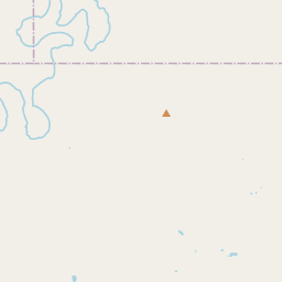
Locationbig map

| UTM (WGS84 Datum) | 14S E 431002 N 3641334 |
|---|---|
| Decimal Degrees | 32.90805000, -99.73783333 |
| Degrees and Decimal Minutes | N 32° 54.483', W 99° 44.27' |
| Degrees, Minutes and Seconds | 32° 54' 28.98" N, 99° 44' 16.2" W |
| Driving Directions | Google Maps |
| Area Code(s) | 325 |
| Which side of the road? | Marker is on the right when traveling North |
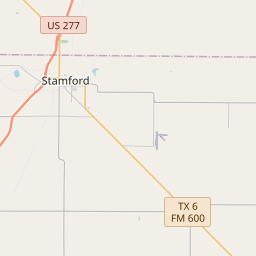
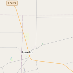
| Closest Postal Address | At or near FM704, Avoca TX 79503, US |
| Alternative Maps | Google Maps, MapQuest, Bing Maps, Yahoo Maps, MSR Maps, OpenCycleMap, MyTopo Maps, OpenStreetMap |
Is this marker missing? Are the coordinates wrong? Do you have additional information that you would like to share with us? If so, check in.
Nearby Markersshow on map
Maintenance Issues
- Is this marker part of a series?
- What historical period does the marker represent?
- What historical place does the marker represent?
- What type of marker is it?
- What class is the marker?
- What style is the marker?
- This marker needs at least one picture.
- Can this marker be seen from the road?
- Is the marker in the median?
Comments 0 comments